Last Updated on September 5, 2023 by Grant
The relatively small eastern Utah city of Moab is home to two of the state’s five National Parks: Canyonlands and Arches. Both parks are incredible, showcasing two vastly different landscapes. Canyonlands is the larger of the two parks, consisting of several different districts. This Canyonlands National Park Itinerary will help you plan the perfect visit to this park full of buttes and canyons carved by the Colorado and Green Rivers.
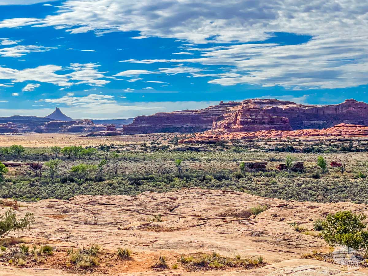
The two rivers that define the landscape here also define the park’s four districts. North of Moab is the Island in the Sky district, the most visited unit of the park. South of Moab is the more remote Needles district, which lies east of the Colorado River. The extremely remote area known as the Maze lies west of the Colorado River and is perfect for visitors looking for a true wilderness experience. The fourth district is the rivers themselves.
The three land districts are not connected by direct roads. Additionally, each district is fairly large. We suggest allowing at least two days to visit the two developed districts of Island in the Sky and the Needles. Unless you plan to do some extensive hiking or drive the backcountry roads, you can see each unit in a single day. Getting to The Maze requires considerably more time, effort, and skill.
(Disclaimer: When we link to places where you can buy our stuff or places we stayed, we are using special codes that earn us commissions on the sales at no additional cost to you. Please see our Review Policy for more information.)
Visiting Canyonlands National Park
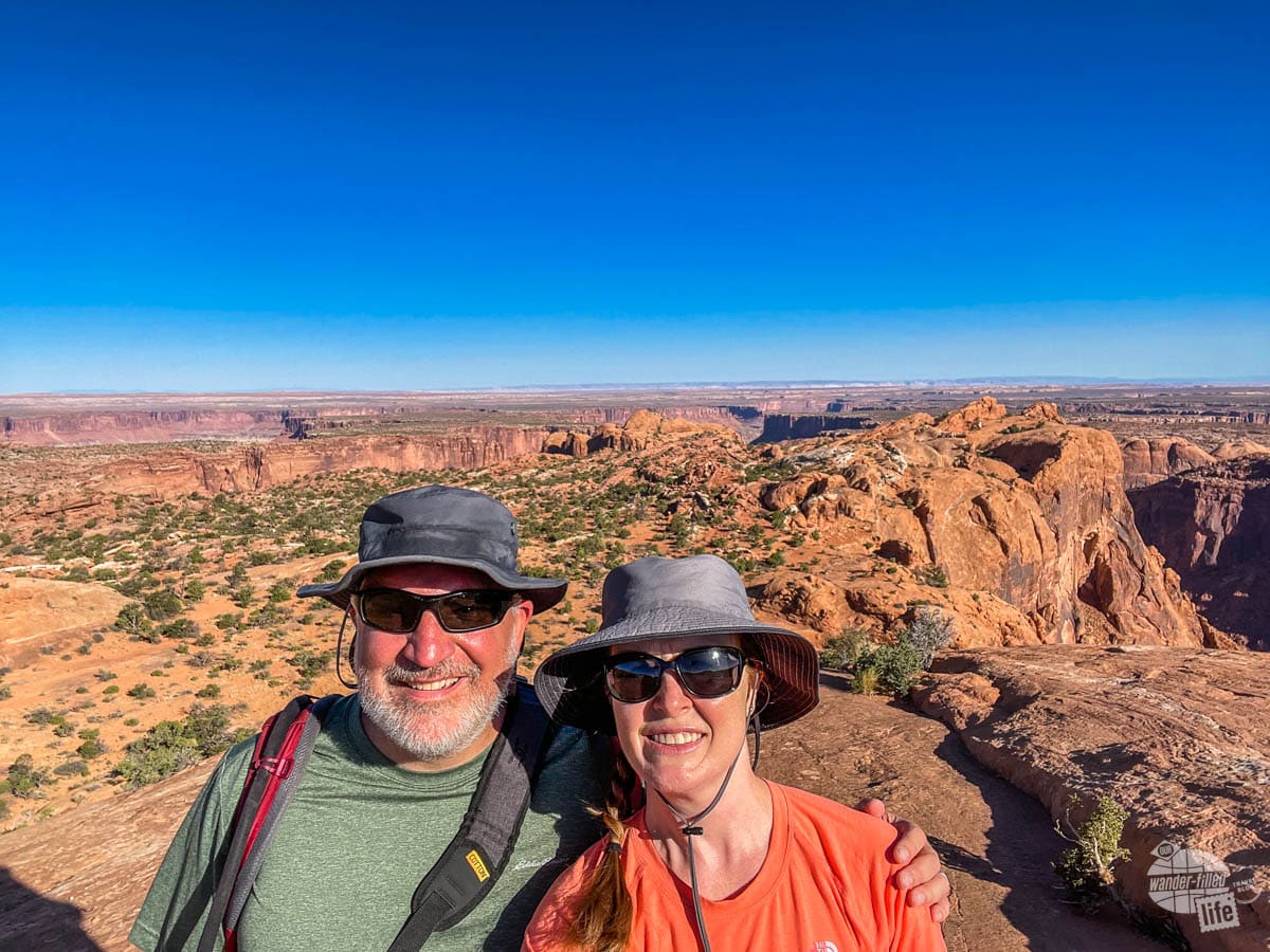
If you only have one day, we suggest that you spend it at the Island in the Sky district. This area is the easiest to reach from Moab and offers the most development. Still, there are very few services available inside the park. Be sure to bring plenty of water, snacks, food and any other supplies you might need.
Additionally, we suggest you start your day early. If visiting Canyonlands National Park in the warmer months, getting an early start on your day allows you to beat the heat. This is especially important if you plan to do any hiking.
Check out our recommendations for essential hiking gear.
While Canyonlands’ Island in the Sky district is not nearly as crowded as its neighbor Arches National Park, the parking lots can still fill quickly. Arriving early gives you a better opportunity to see the sights before they are too crowded. You won’t necessarily have to worry about crowds of people at The Needles district but it is a somewhat long drive from Moab. We suggest allowing yourself plenty of time so you don’t have to drive back in the dark.
Day 1: Island in the Sky
From Moab, you’ll drive north and then turn south to enter the Island in the Sky district of Canyonlands National Park. If you plan to arrive before the visitor center opens, be sure to download a park map before leaving town. You’ll get snippets of cell service in the park, especially at areas of high elevation, but it’s a remote area so expect to spend most of your day disconnected.
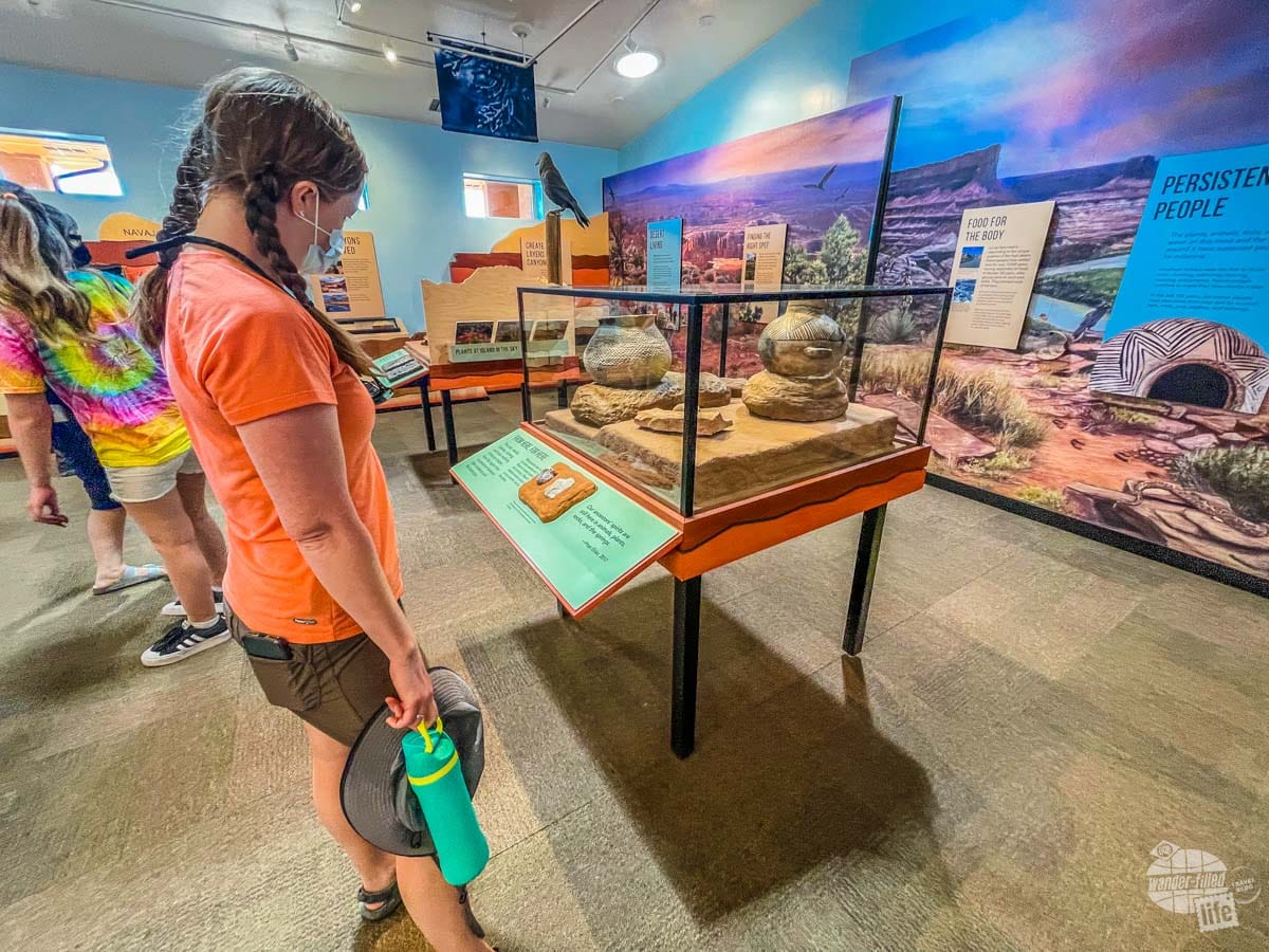
If it’s open, stop at the Island in the Sky Visitor Center, which is just a few miles inside the park’s entrance gate. This is a relatively small visitor center, but the film and exhibits offer a great introduction to the park’s geology and landscape. The bookstore here is also a great place to pick up a park stamp or a few souvenirs.
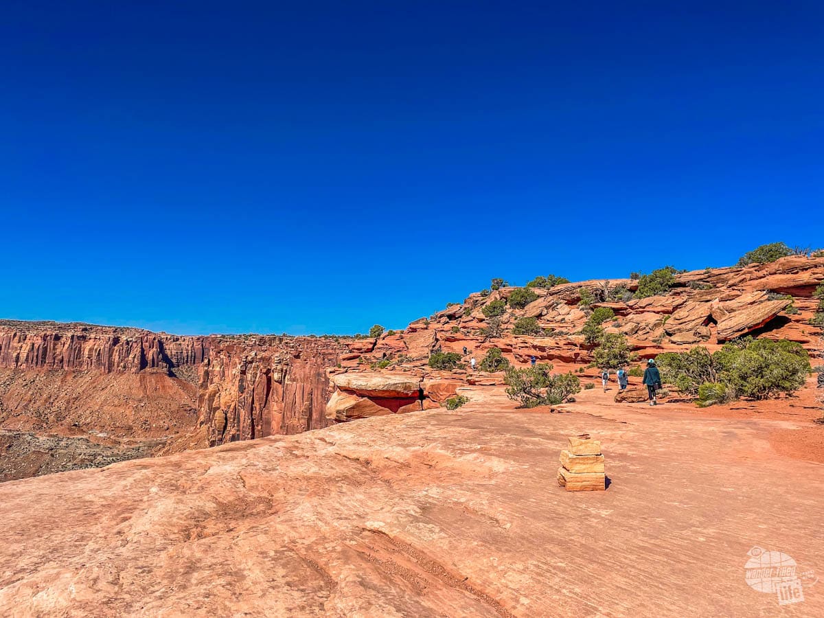
Mesa Arch
Your next stop should be Mesa Arch, which is popular at sunrise and early morning. From the parking lot, it’s a 0.25-mile hike to the namesake arch along a cliff edge. The trail is fairly easy to hike but it is over uneven ground. Once you reach the arch, you can scramble over boulders for views and photographs of the arch and surrounding landscape.
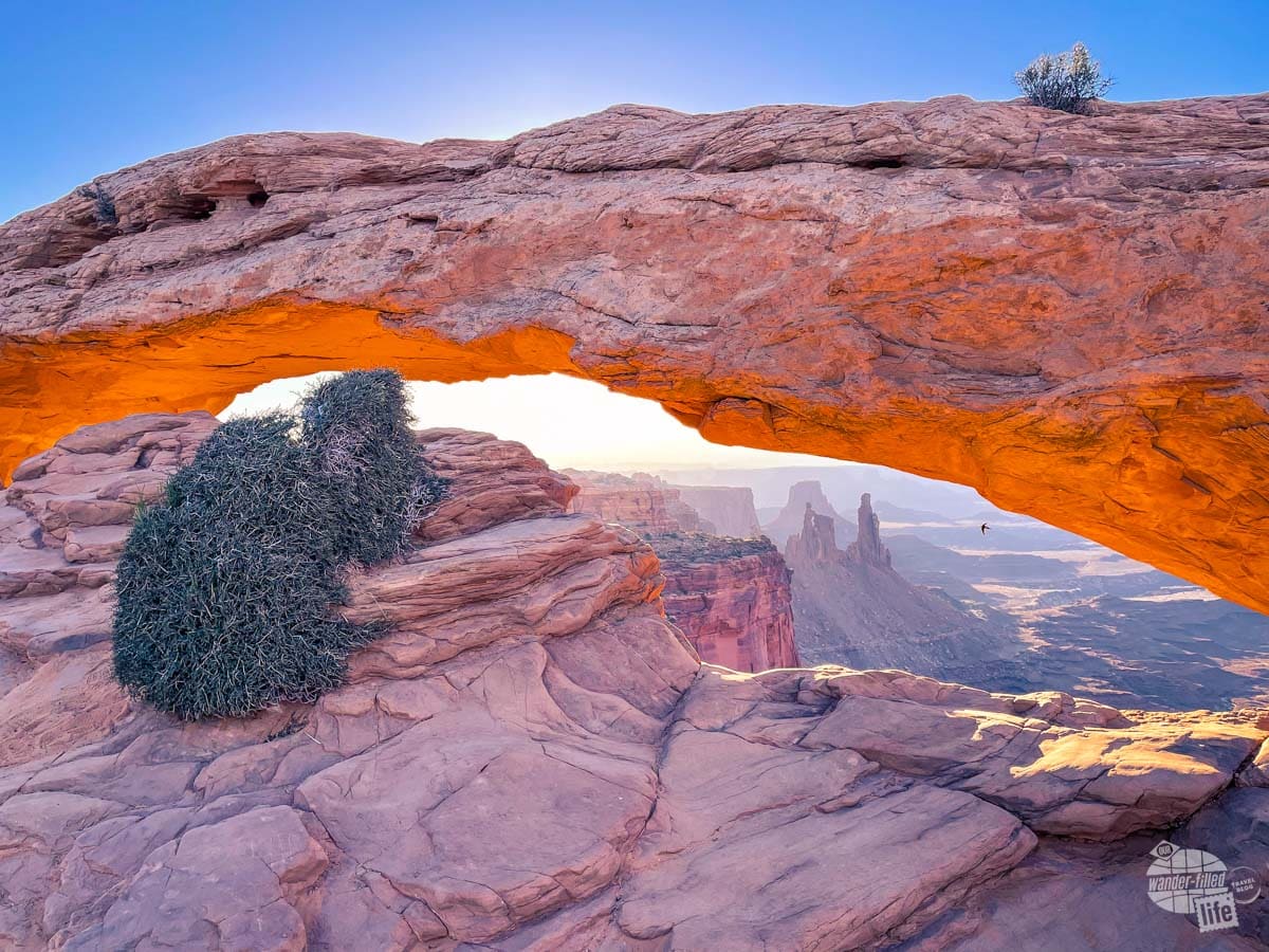
Sunrise photographers try to capture the sun as it peeks between the distant horizon and the arch. Don’t worry too much if you miss the sunrise, though, the views are fantastic any time of day!
Get our iPhone photography tips for beginners here.
From the arch, look carefully for a trail that creates a loop circling back to the parking lot (or just return the way you came). We spent a total of about 45 minutes hiking and taking pictures here. You could certainly spend more or less time, depending on your interests.
Upheaval Dome
Back in your car, the main road forks just past Mesa Arch. Turn right and follow the road all the way to the end, which is where you’ll find Upheaval Dome. From the parking lot at the end of the road, a moderate 1/2-mile hike takes you to the first of two viewpoints of this geological curiosity.
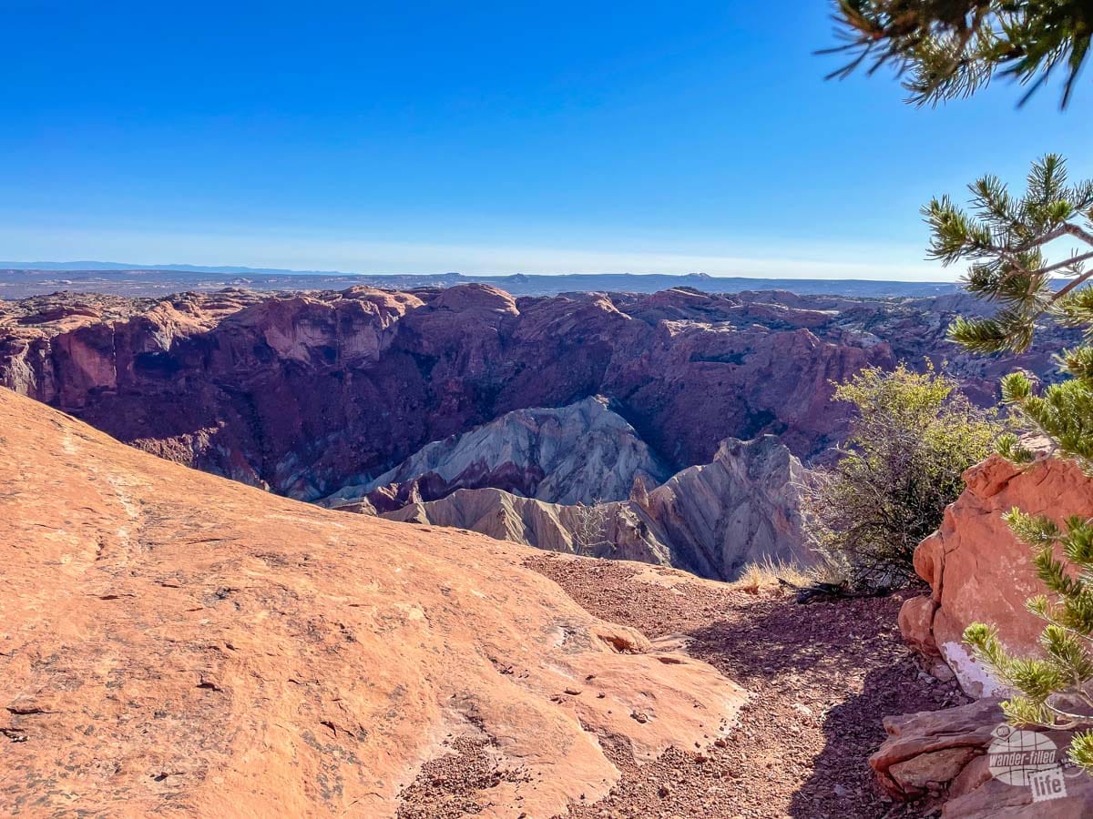
Geologists do not know exactly how this rocky crater was created. Exhibit panels at the first overlook explain two leading theories. The uphill hike to this point is not too strenuous but it does cross some rocky terrain. Be sure to wear proper hiking shoes.
At the top, you can return to the parking lot or extend your hike to the second overlook. This second part of the trail is a little more difficult, requiring you to follow cairns laid out over slickrock. There are also a few areas where we had to navigate some fairly narrow sections of rock with relatively steep drop-offs.
I’ll be honest, I did not personally love the hike to the second overlook. There were some incredible views but I’m not sure that they were different enough from the first overlook to be worth the stress. But, I’m not a fan of heights or exposed narrow rock. Grant absolutely loved the entire hike and did not have any hesitation about following the trail.
You’ll have to make the decision for yourself if you continue past the first overlook. If you do, make sure you have good hiking shoes and watch carefully for the trail markers. The hike to the first overlook is definitely worth it, though!
Green River Overlook
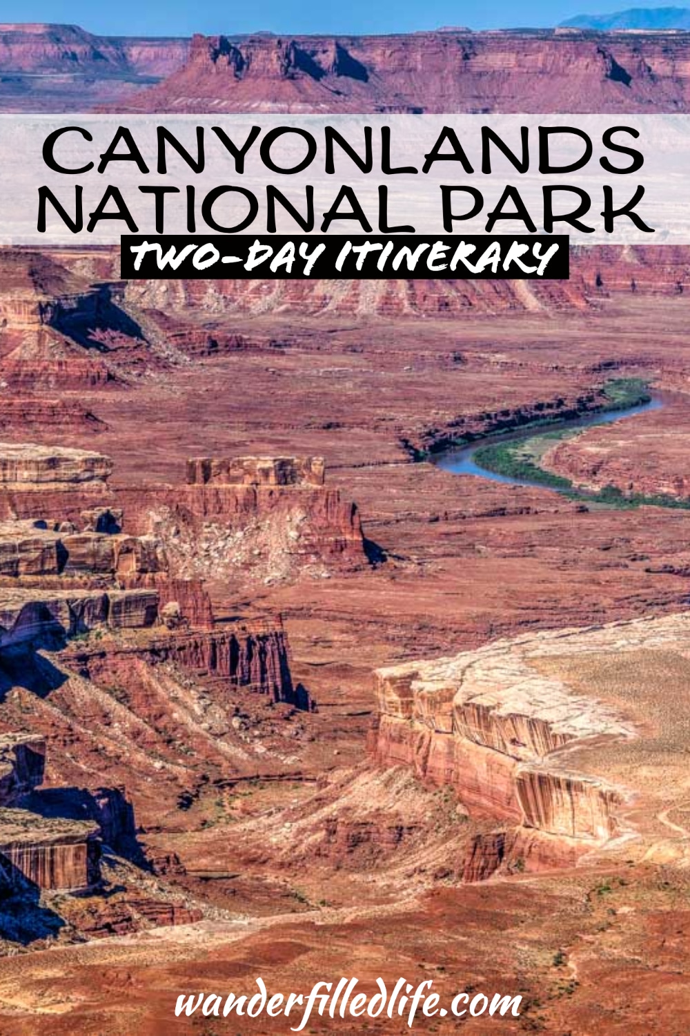
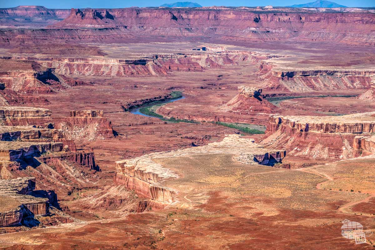
Back near the fork of the main road, yes sure to stop at the Green River Overlook. From this south-facing overlook, you’ll have seemingly unending views of the Green River and the surrounding red rock landscape about 1300 feet below. This is a great place to just stop and take a few minutes to enjoy the vast, rugged landscape of Canyonlands National Park.
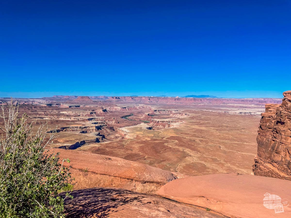
Also, keep your eyes peeled for White Rim Road, a backcountry road that snakes across the Island in the Sky district. Driving this road requires a high-clearance, four-wheel-drive vehicle and generally takes at least 2-3 days.
On the opposite side of the Green River, you’ll see the remote park unit known as The Maze. From here, you can really see why getting to this unit of the park is difficult. A visit to this area of the park should only be attempted by those that possess the necessary self-sufficiency to travel and camp in extremely primitive conditions.
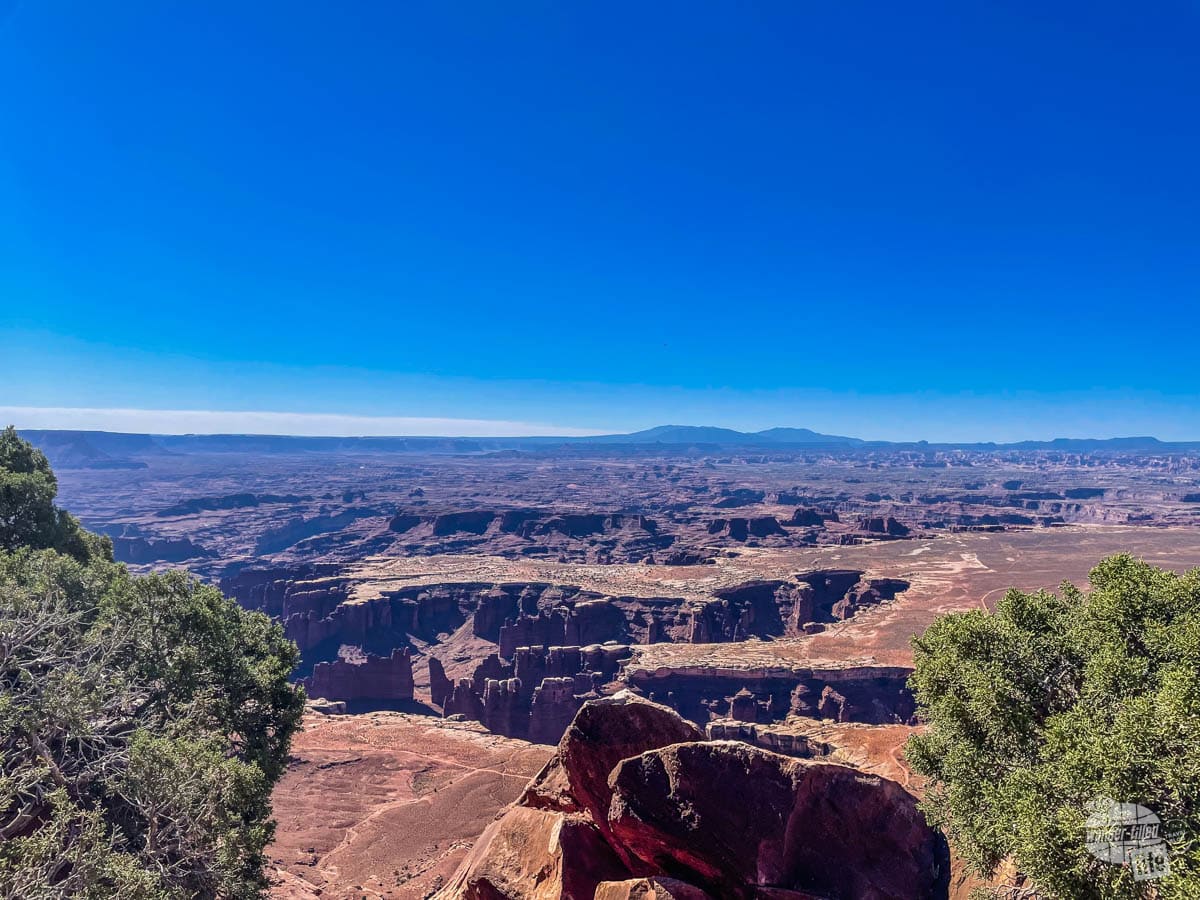
Grand View Point Overlook
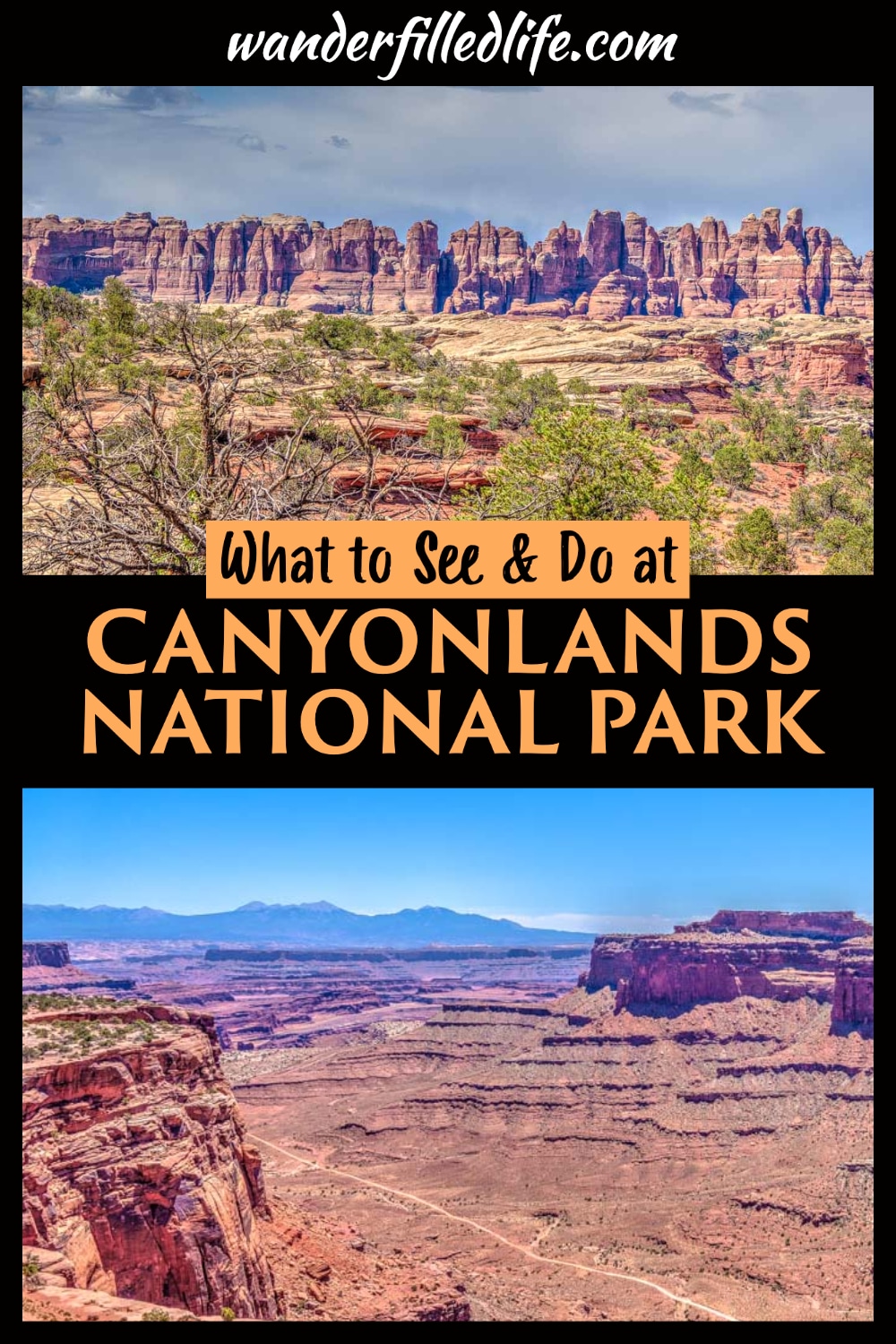
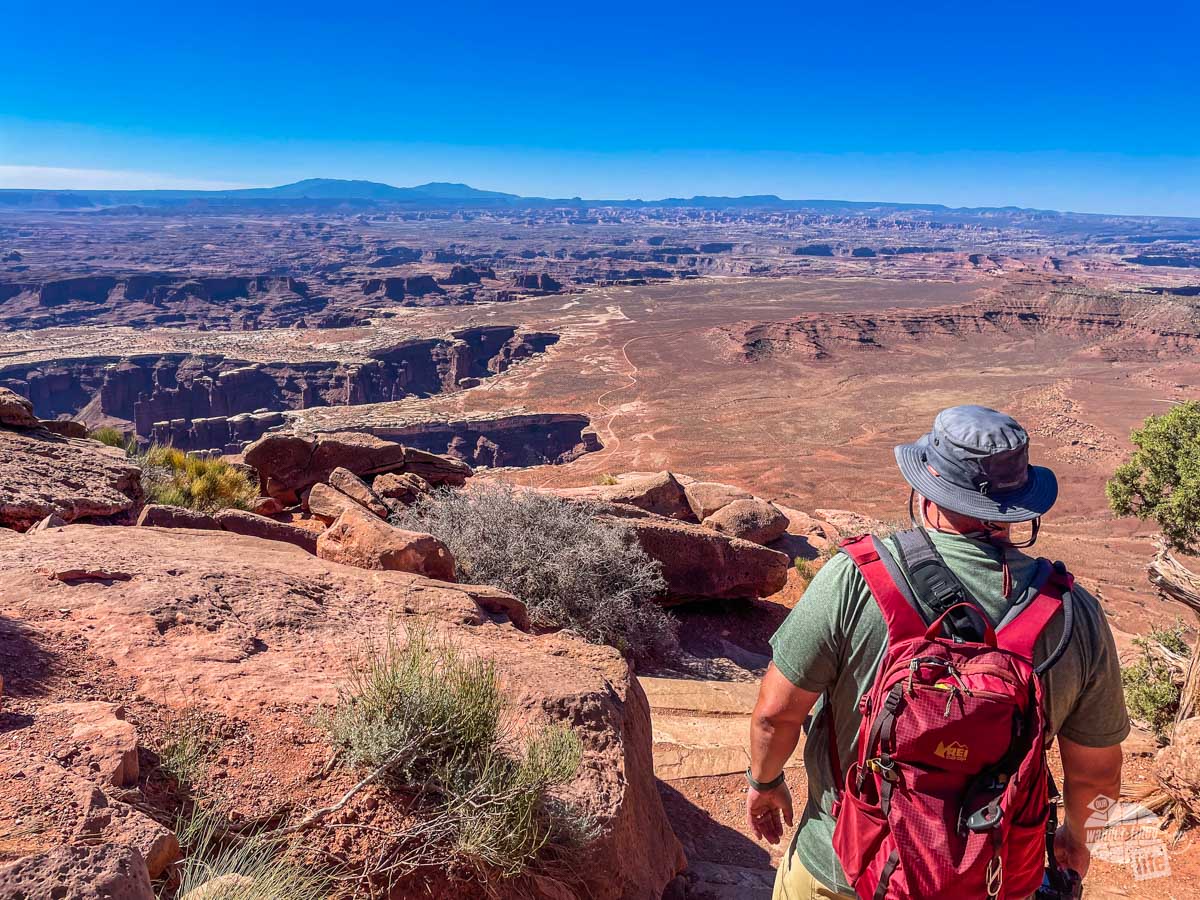
Continue driving the main road south to the Grand View Point Overlook and Trail. A short, paved path takes you to yet another overlook offering some of the best views in the park. Be sure to walk around the large overlook and enjoy panoramic views of the canyons, rivers and backcountry roads stretching out before you.
From the overlook, a rocky but fairly easy two-mile (roundtrip) trail takes you along the canyon wall to another viewpoint. Along the way, you’ll have views out over the canyon landscape to both the south and north. While the trail is mostly flat, you will be walking over uneven rocky terrain with little to no shade. Be sure to wear sturdy shoes and carry plenty of water. As this is an out-and-back trail, you can turn around early if needed.
You can often find ranger talks on the geology of the park at the overlook here. Check the park’s website or the visitor center for a schedule of events.
Picnic Lunch
When you’re ready for lunch, stop at one of the three picnic areas. The two nicest ones are at Upheaval Dome and the White Rim Overlook trail (near Grand View Point Overlook). At both of these, you’ll find covered tables with individual parking. Both are tucked away, off the main road and provide a great place to relax in the shade.
There are also a few picnic tables by the visitor center. Unfortunately, these are right off the main road and this area can be very busy. You’ll also likely have a steady stream of cars passing by.
Wherever you choose to eat, be sure to clean up after yourself and remember to never feed wildlife.
Shafer Canyon Overlook
As you make your way out of the park, stop at the Shafer Canyon Overlook, which is just south of the visitor center. Here, you’ll have views off to the east and onto the Shafer Trail Road.
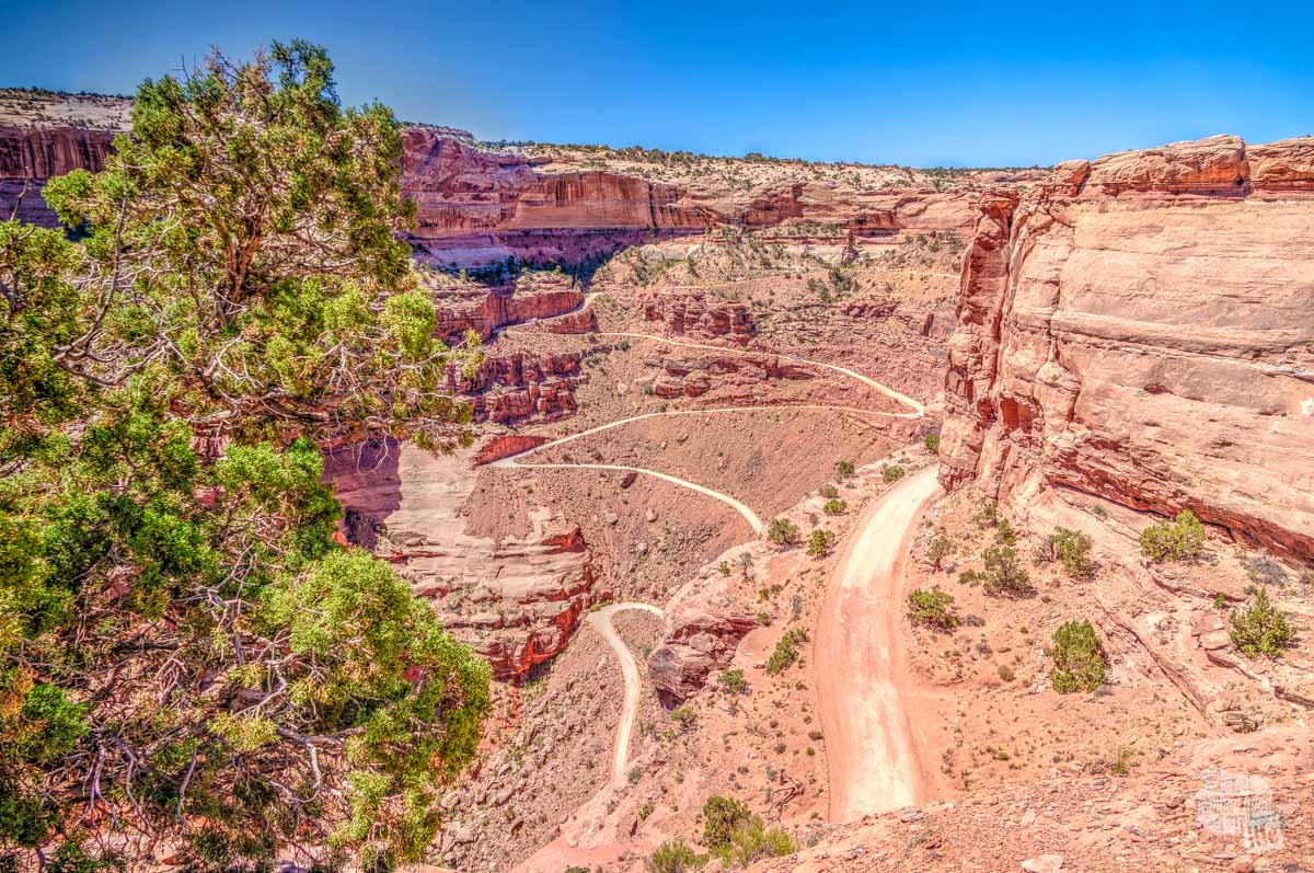
This historic route has been used by Native Americans, sheepherders, uranium mining and, now, recreation. If you want to drive this road, the park highly recommends a high-clearance, four-wheel-drive vehicle. You do not need a permit, though. Still, we recommend that you check in with a ranger and make sure you have appropriate emergency gear before attempting it.
For those that prefer to stay on the paved roads of the mesa top, the overlook here is incredible. And watching trucks make their way downhill (or uphill) can be entertaining as well!
Day 2: The Needles
Spend your second day at Canyonlands National Park at The Needles district, which is about a two-hour drive south of Moab. Yes, it’s a bit of a drive from Moab but all the roads are paved and easy to navigate.
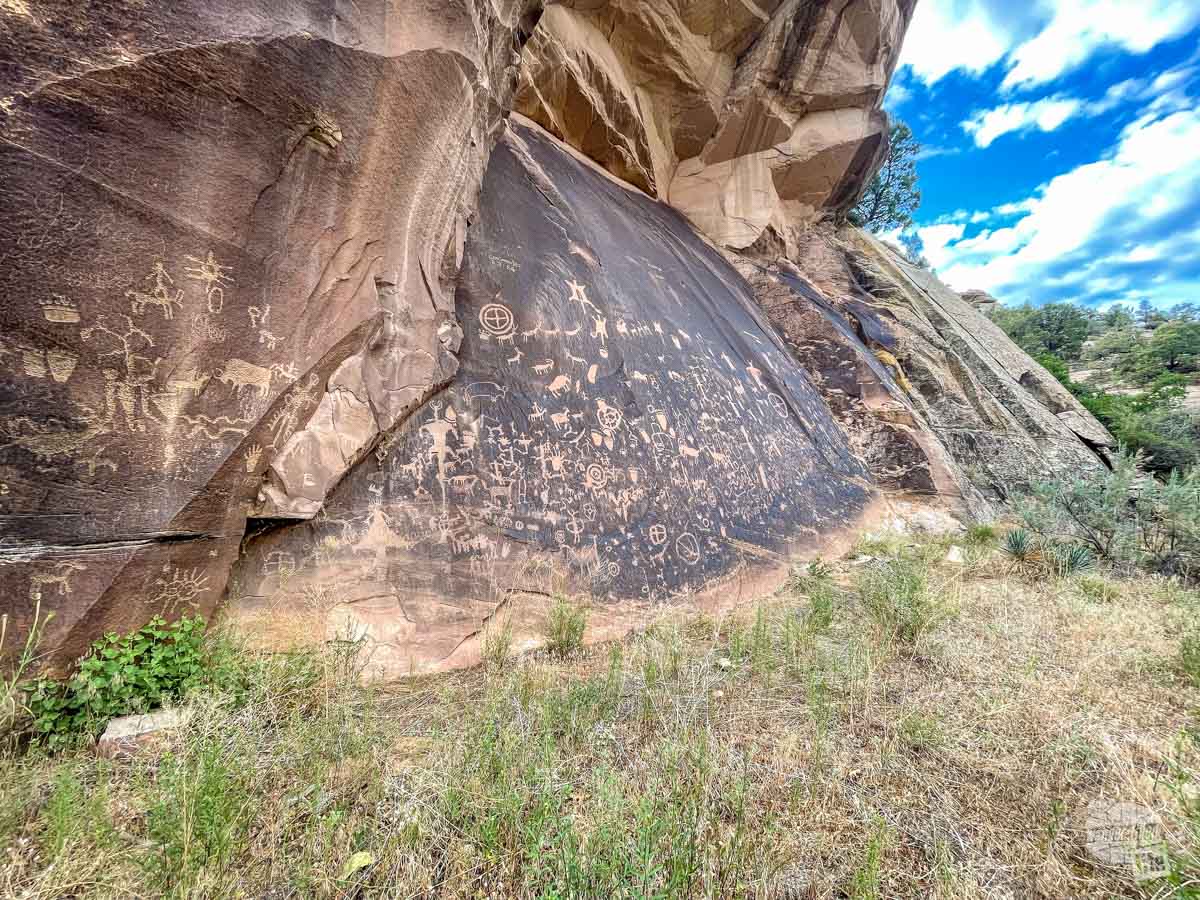
About 20 miles before the entrance to The Needles, be sure to make a quick stop at Newspaper Rock State Historic Monument. This small site preserves a large rock covered with more than 650 prehistoric rock art designs! Best of all, the site is free and you just have to walk a short, paved path from the parking lot. This really is one of the easiest places to view petroglyphs in the area.
Continue into Canyonlands National Park and be sure to stop at the small Visitor Center. This is a great place to ask a ranger about current conditions and get personalized recommendations based on your interests.
Roadside Ruin
Just a short way past the visitor center, you’ll have a chance to briefly stretch your legs on the Roadside Ruin trail. This short walk takes you along an easy trail to a preserved granary built by Ancestral Puebloans.
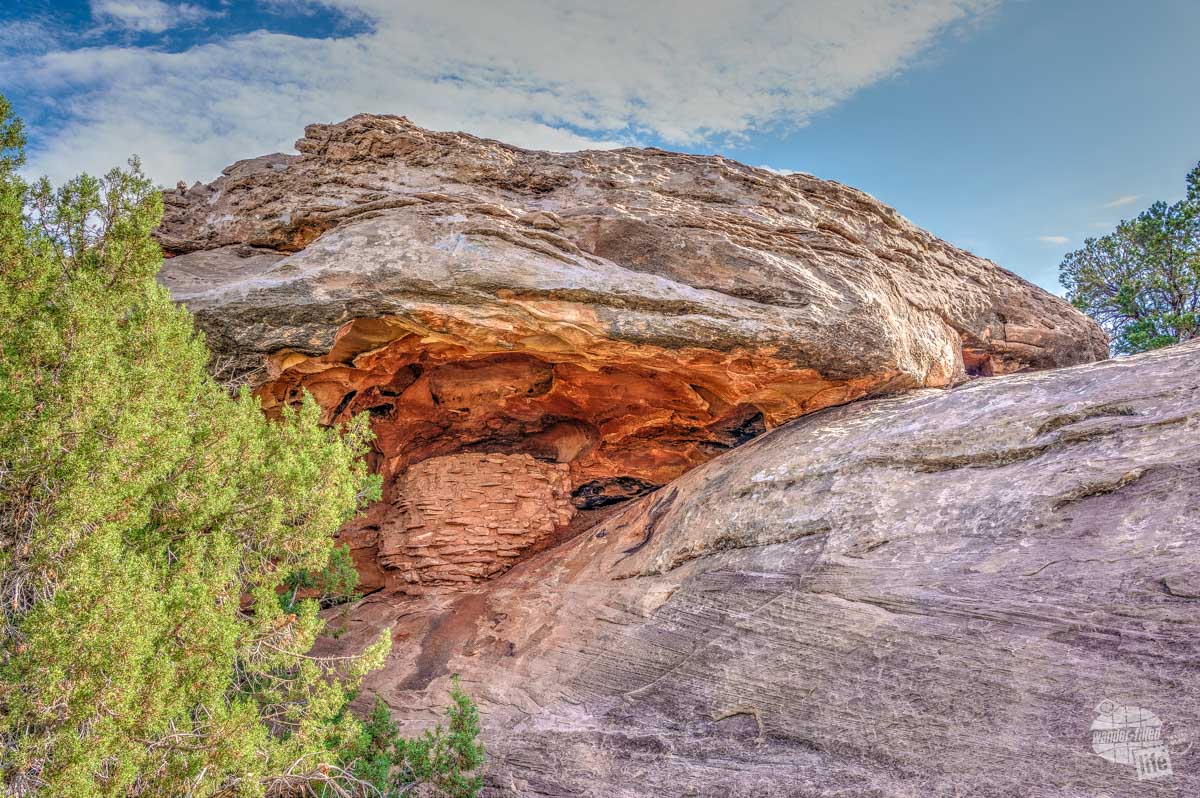
This 0.3-mile trail should only take about 15-20 minutes and is easy enough for anyone to handle.
Cave Spring
Continue down the main road and follow signs to turn left towards Cave Spring. The final mile of the drive is on a well-maintained unpaved road that should be suitable for any vehicle.
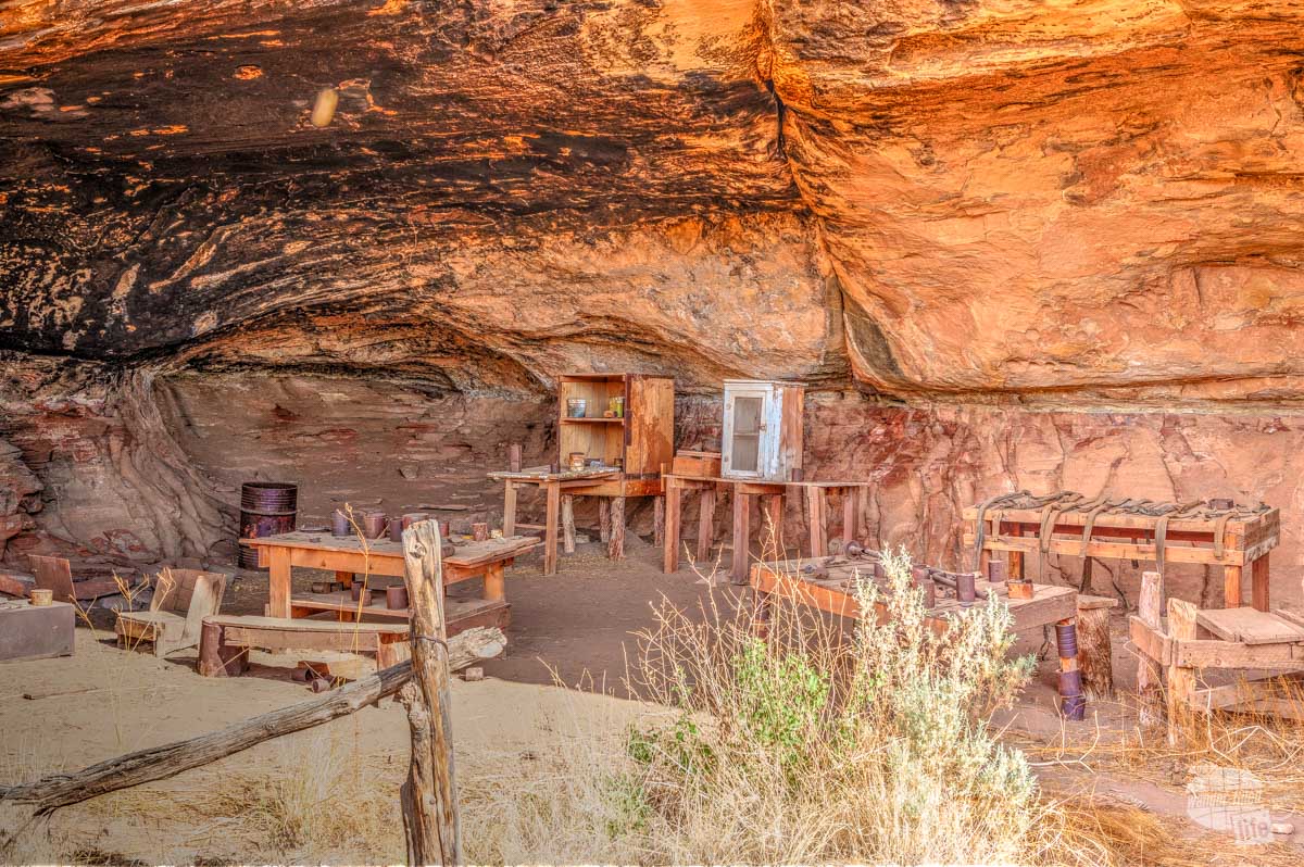
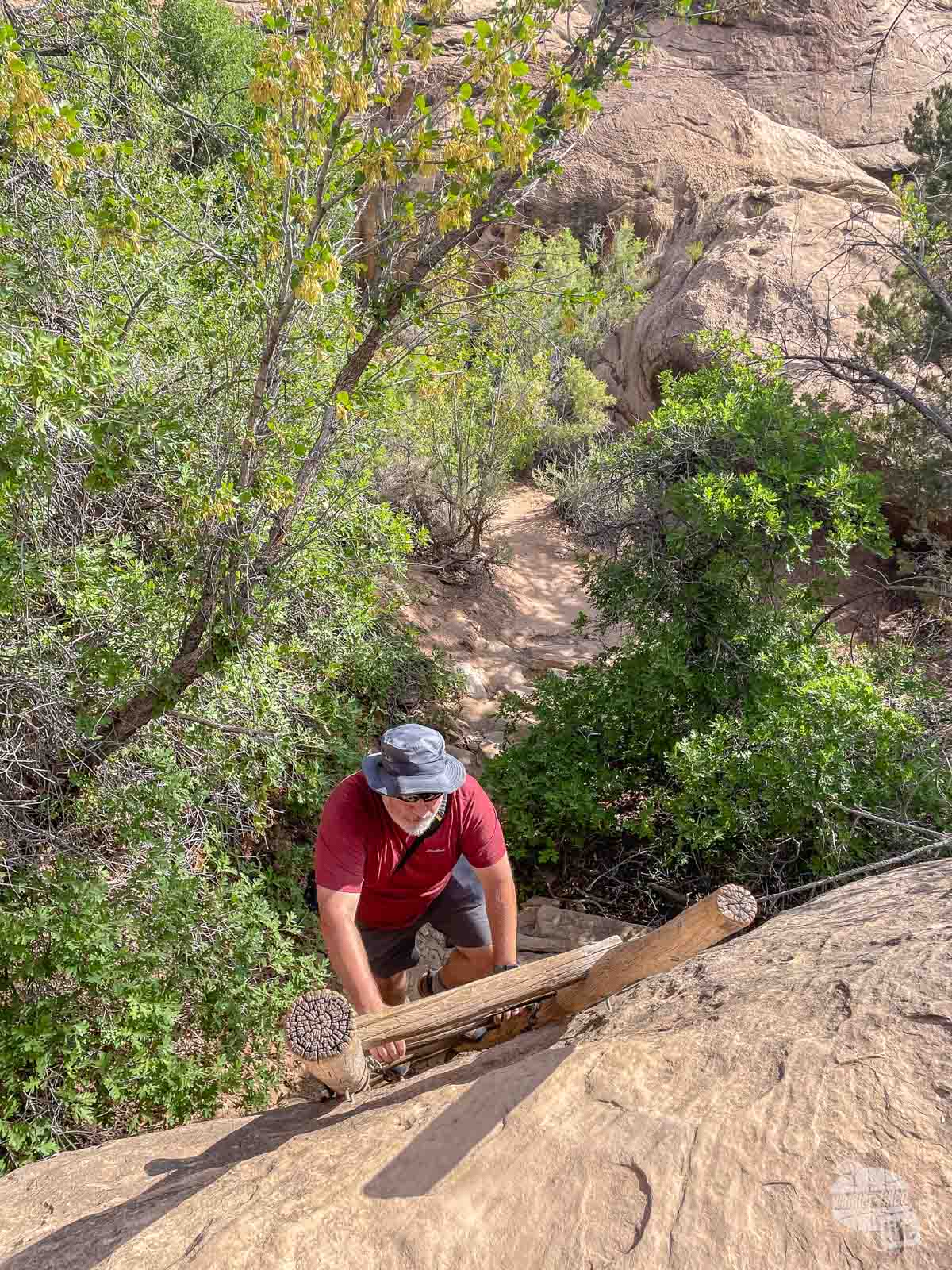
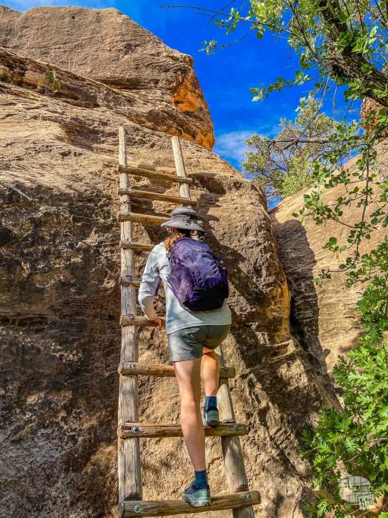
This short loop trail takes you past a historic cowboy camp, the namesake cave spring and a few rock paintings. The trail to these three highlights is relatively flat and easy. To complete the full 2/3-mile loop, you’ll have to climb up two short ladders. If you are able to navigate the ladders, we highly recommend you complete the full loop, as there is some incredible scenery along the way.
If you cannot make it up the ladders, though, you can simply retrace your steps back to the parking lot. Allow about 30-minutes for the full loop, though you could easily take longer just enjoying the views.
Pothole Point
A little farther down the main road, we really enjoyed the trail at Pothole Point. The 1/2-mile trail here takes you across slickrock, so be sure to wear sturdy shoes with good tread. Also, be sure to keep a close eye on the cairns outlining the trail.
All over the rocky landscape of southern Utah, you’ll find natural potholes in the rock. While these small depressions in the rock might seem odd, they play a vital part in the desert ecosystem. After a rainstorm, water gets trapped, providing a natural trough for animals in search of water.
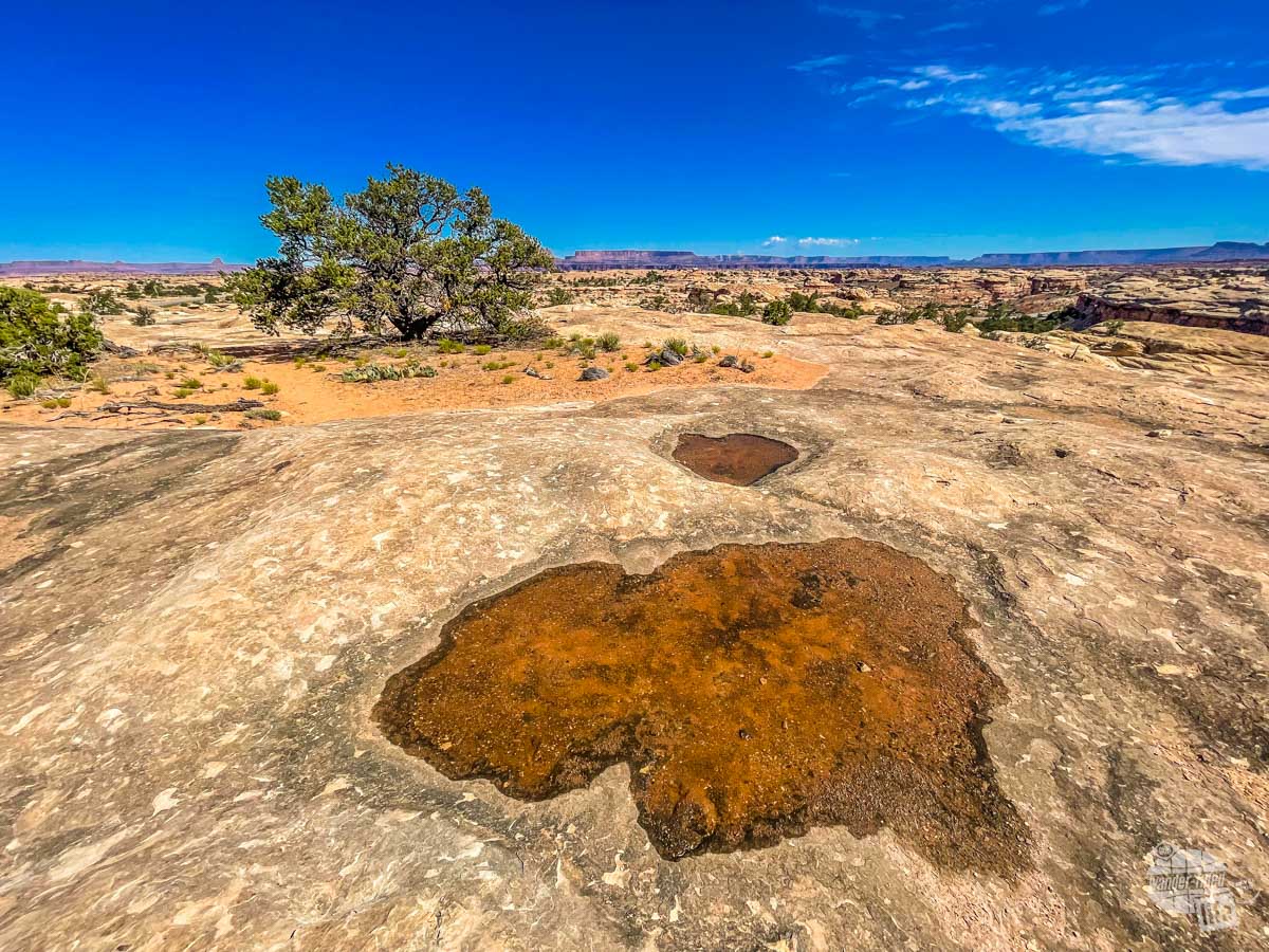
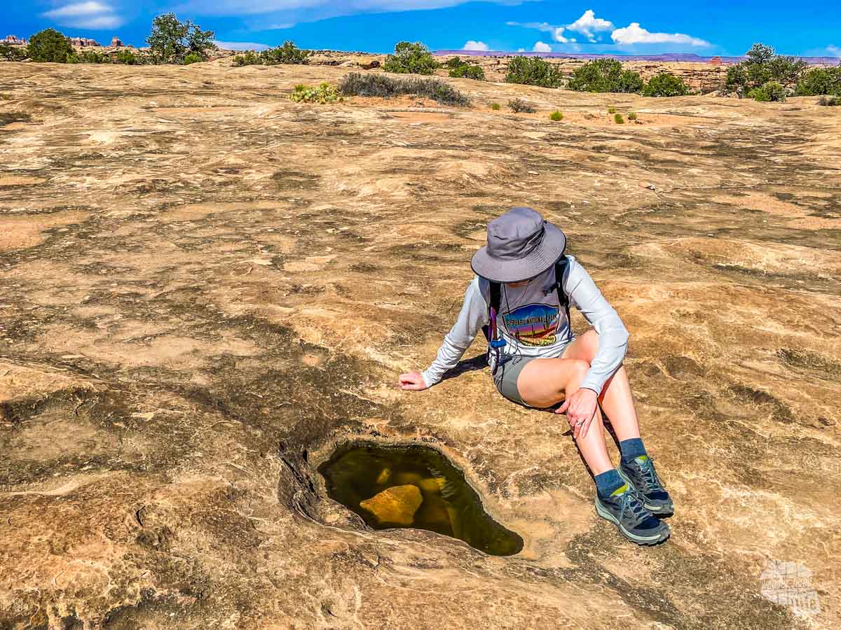
Additionally, these potholes can house a diverse tiny ecosystem of plants and animals. These organisms must be able to adapt to the harsh desert environment, including drastic temperature changes.
While the life inside these potholes is often difficult or impossible to see, it’s worth taking a look. We actually found a few tadpoles in a couple of them! For this reason, it is important to not step inside a pothole (dry or wet), as any human impact can greatly affect the health of the ecosystem.
Big Spring Canyon Overlook
At the end of the main road, be sure to stop at the Big Spring Canyon Overlook. The view here isn’t as grand as in other areas of the park. But, it’s an interesting look at the varied landscape.
This is also the trailhead for the Confluence Overlook, where you can view the confluence of the Colorado and Green Rivers. That hike is a fairly strenuous 11-mile (roundtrip) hike, so we didn’t do it. It’s definitely on our list if we ever return, though!
Even if you don’t hike, you can spend some time just wandering around the overlook and taking in this remote, rugged wilderness.
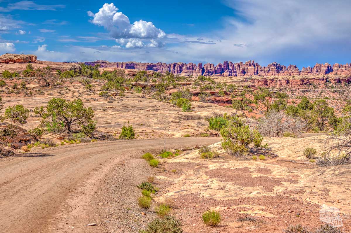
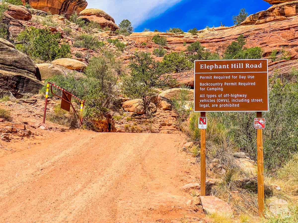
Elephant Hill
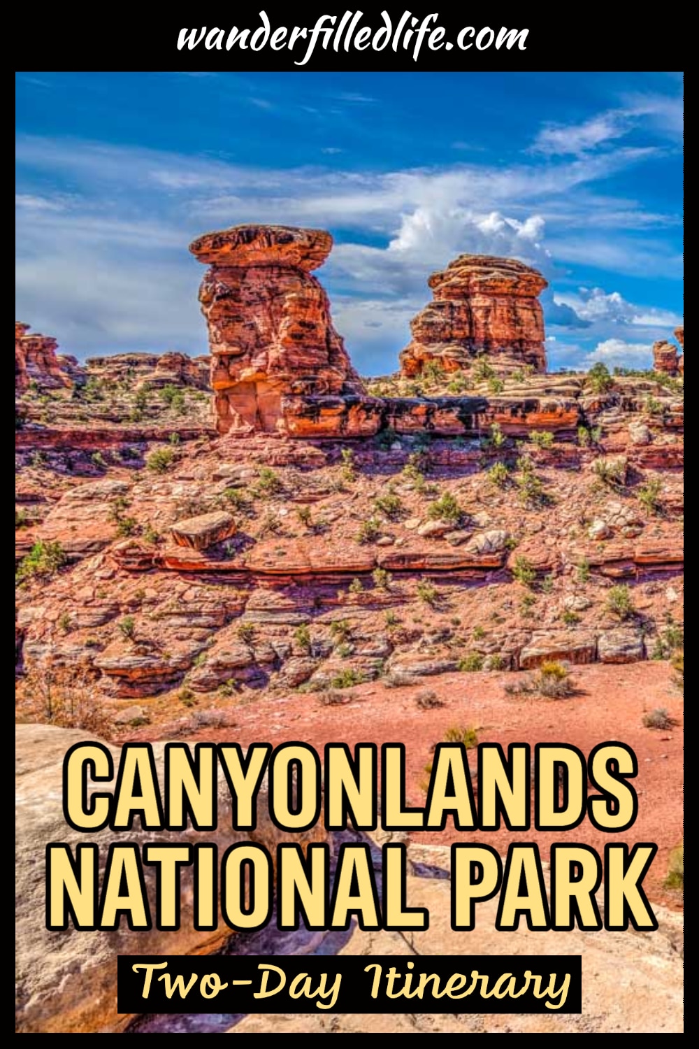
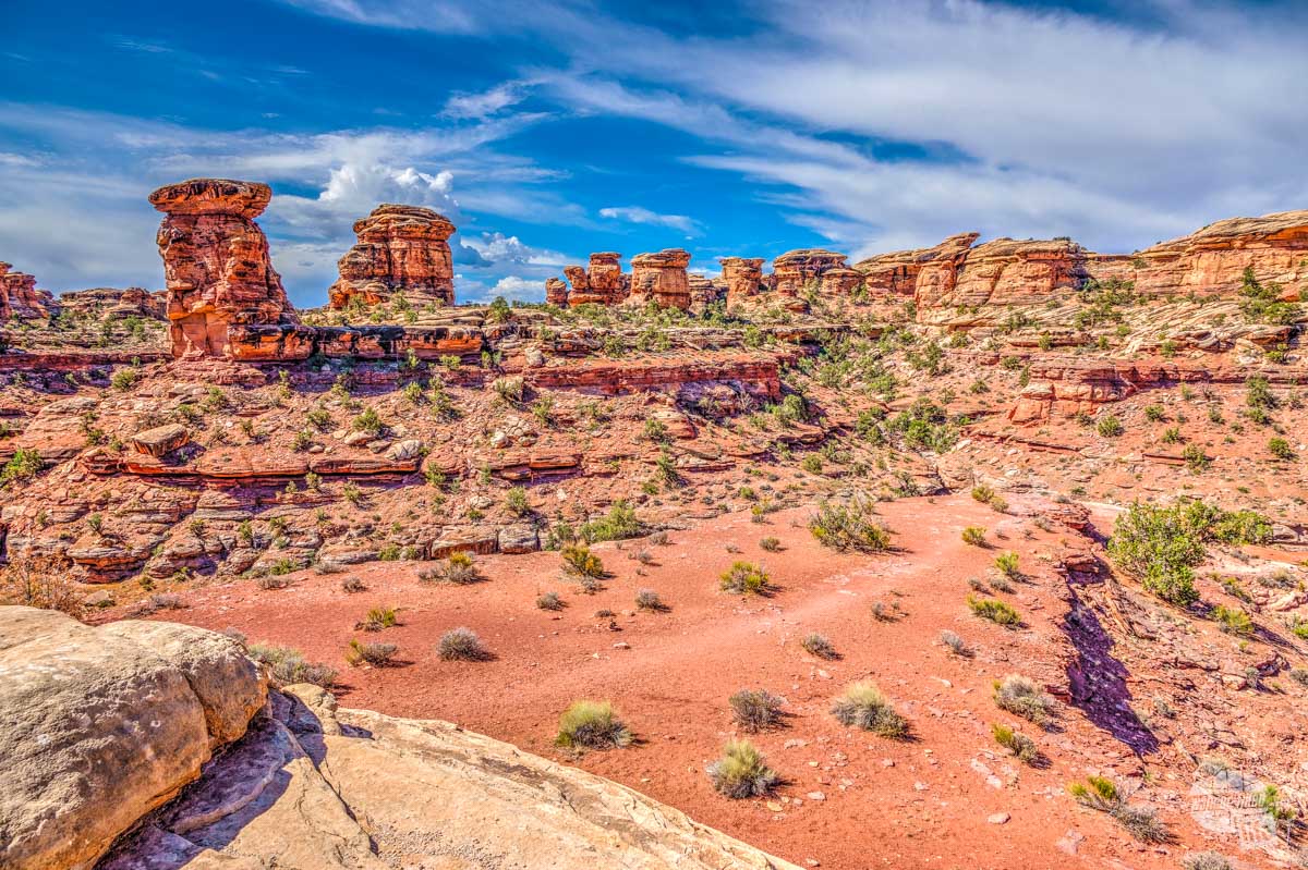
Located off the main road, you can get a taste of the backcountry on the first part of Elephant Hill Road. Additionally, this is one of the best places in the park to see the namesake Needles. These colorful spires are a nice contrast to the canyons and buttes found at Island in the Sky.
The first 3 miles of the unpaved road should be accessible for all vehicles. Still, we definitely recommend that you check with a ranger first if you don’t have high-clearance or four-wheel drive. Conditions on unpaved roads can change with even a little rain, so it’s important to know what to expect.
After that, you must have a backcountry permit to continue. And this part of the road is one of the most technical drives in Utah, featuring steep grades, loose rock and stair-step drops. If you’ve got the right vehicle and skills, go for it… and let us know how it is!
For the rest of us, driving the first few miles is a treat if you like really being off the beaten path.
With More Time Near Canyonlands National Park
If you have more time, there are plenty of other things to do in and around Moab.
There are a ton of longer hiking trails in Canyonlands National Park, in both the Island in the Sky and Needles districts. We were visiting in the summer and while temperatures were not nearly as high as they could have been, it was hot enough to keep us off the longer trails.
As much as we love to hike, there’s just something about hiking in the desert in the midday summer sun that really isn’t appealing. If you’re looking to do some longer hiking, we recommend visiting in the cooler spring or fall months. In the winter, you’ll generally find much smaller crowds and mild temperatures, though snow can occur.
Read more about visiting the Utah national parks in the winter.
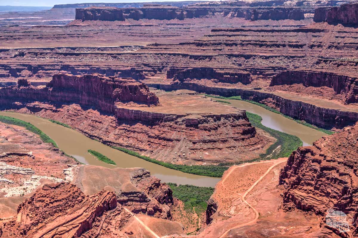
If you just can’t get enough of the canyon landscape, you should definitely make at least a quick stop at Dead Horse Point State Park, which is located right by the entrance to Island in the Sky. Actually, this is where we did the most hiking, as there are a number of relatively easy trails that don’t take you too far into the backcountry.
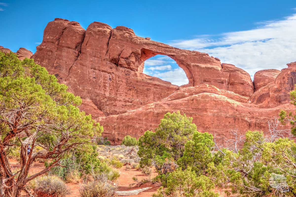
Additionally, you can easily spend a day or two at Arches National Park. In fact, you’ll pass right by the entrance to Arches as you drive north from Moab to Island in the Sky. With the densest collection of natural arches in the world (over 2,000), the landscape of Arches National Park is a stark contrast to that of Canyonlands NP.
Check out our articles on visiting Arches National Park and Dead Horse Point State Park.
Finally, the red rock desert surrounding Moab is truly a vast playground for outdoor explorers. There are a ton of opportunities for off-road adventures, whitewater rafting, canyoneering and more.
Where to Stay in Moab
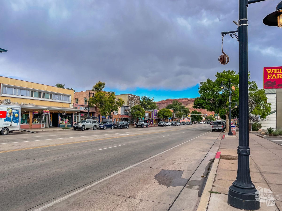
Moab really is a cute little town with a great downtown area. Despite the popularity of the parks and the town itself, it has retained its small-town charm and relative lack of big-box stores (nope, there’s still no Walmart). That said, you’ll find plenty of restaurants, hotels, campgrounds and shops.
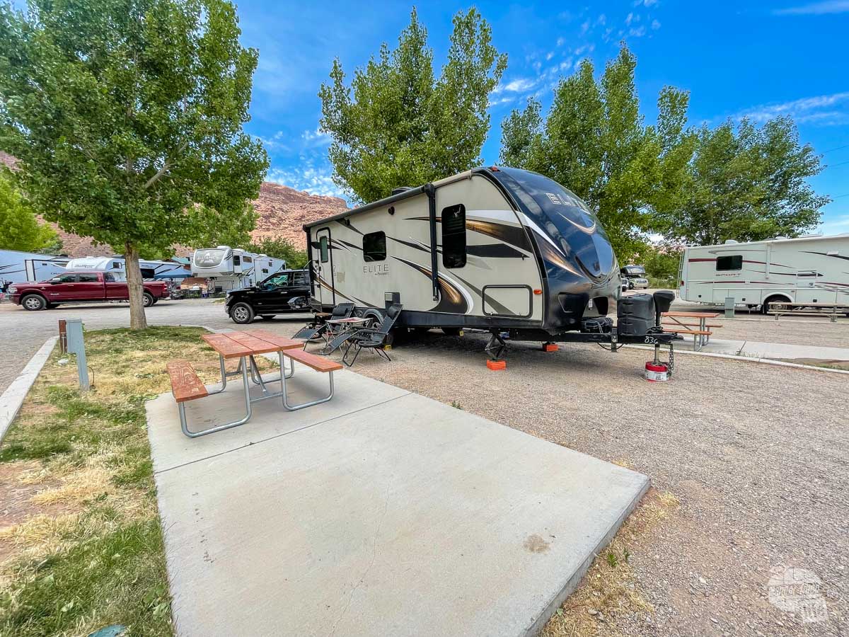
We camped at the Moab Rim Campark, an RV park on the south end of town. In addition to RV sites, they have a few tent sites and even some cabins. Perhaps the only downside to the campground is its proximity to the highway.
Our site was on the first row, right off the main highway and we heard a ton of road noise all day and night. Everything else was great, though! The entire campground, including the bathrooms, was well-kept and clean. We would recommend the park, but you should see if you can get a site farther back if you think road noise will bother you.
Read our full campground review on RV Life here.
If you prefer a hotel, there are a number of great options in town. Several years ago, we stayed at the Hampton Inn for a quick visit in the winter. Most hotels, including the Hampton Inn, are within walking distance to downtown and a variety of restaurants.
Read TripAdvisor Reviews | Book the Hotel
Where to Eat in Moab
In terms of where to eat, we highly recommend breakfast at the Moab Diner, lunch at the Moab Brewery and dinner at Hidden Cuisine. The Moab Diner serves up traditional diner fare, including a variety of skillets featuring potatoes, bacon, peppers, eggs and cheese. The Moab Brewery is a great place to get a local craft beer after a long hike or a day in the sun.
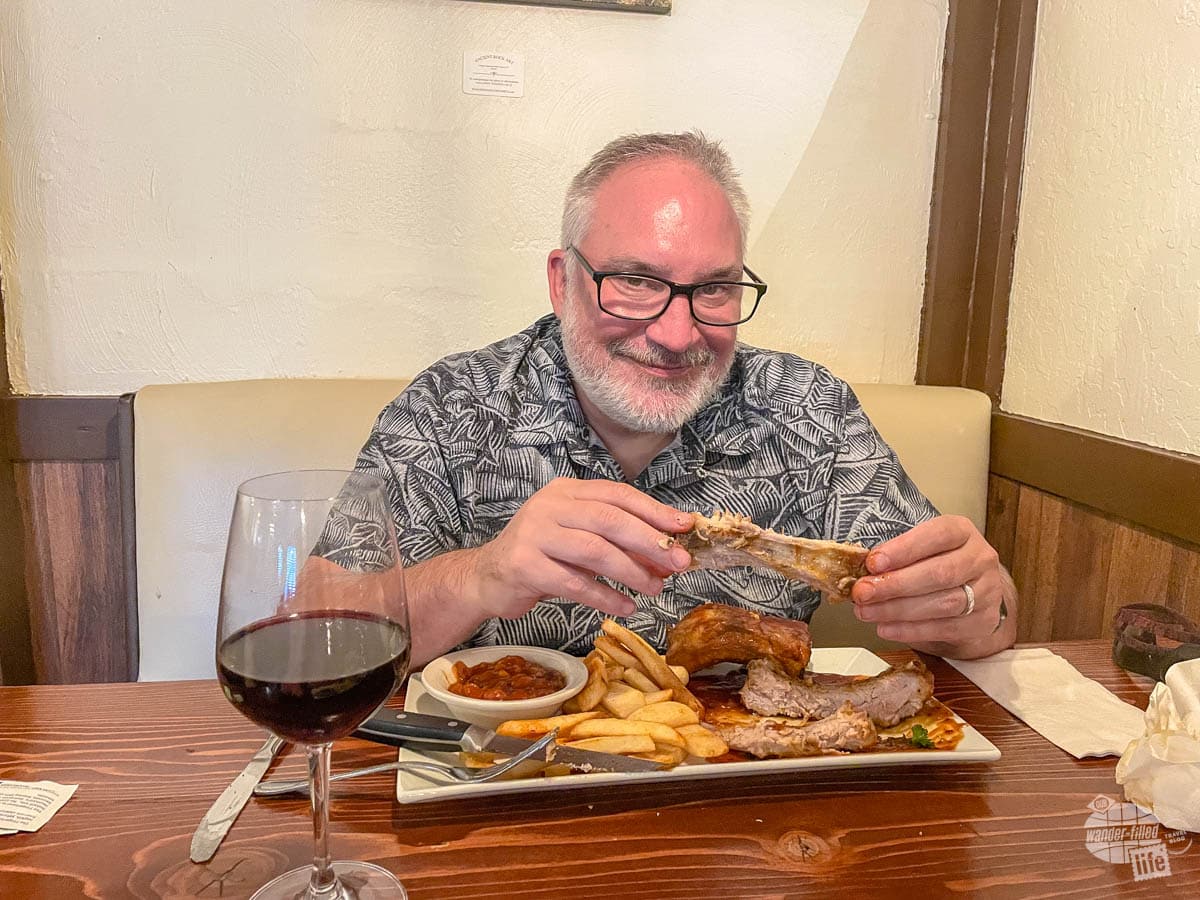
Finally, Hidden Cuisine serves up authentic South African-inspired cuisine that you just don’t find in a lot of places. I thoroughly enjoyed the Bobotie, which is a fantastic beef stew topped with an egg custard. Grant opted for the South African Style Ribs, which were tangy and perfectly tender.
We would also recommend Antica Forma if you are looking for pizza, pasta or other Italian fare. While we didn’t eat at the Moab location, we went to their location in Vernal, UT, when visiting Dinosaur National Monument. I have to say, the pizza we got there rivaled the pizza we’ve had in Italy.
Read more about our visit to Dinosaur National Monument here.
Final Thoughts on Visiting Canyonlands NP
When planning your Canyonlands National Park itinerary, my number one recommendation is to allow enough time to actually enjoy the park. If possible, you should definitely visit both Island in the Sky and The Needles. Each of these units is reasonably well-developed and easy for anyone to visit.
Yes, getting to each of them is a bit of a drive from Moab. Still, they preserve wildly different landscapes and seeing them both is a real eye-opener to the variety of the geological forces that have shaped our land.
You can easily see each area in a day or less if you aren’t doing any extended hiking. Due to their locations, though, seeing them both in a single day would be difficult. And, if you do want to do some longer hikes, there are tons of options in both districts.
What we loved most about Canyonlands National Park is the brilliant landscape that just keeps getting more and more majestic. Seriously, just when you think you’ve seen the grandest, most awe-inspiring view, the next one still takes your breath away.
There’s just something about those views that we can’t get enough of!
Travel Resources
What do you use to find a flight?
We use Skyscanner to find deals on flights. Skyscanner has a great interface and compares tons of airlines for the best pricing and routing. That said, it does not always have every airline and some airlines will have better deals on their website. Still, Skyscanner is a great place to start.
Click here to search for a flight.
What do you use to find a hotel?
We typically stay at Hilton properties, so we use the Hilton website. You can find good Hilton Honors discounts or AAA discounts for a hotel there. We make great use of our free night certificates from our Hilton Honors American Express.
Click here to book a Hilton property.
If there are no Hilton properties available, we use TripAdvisor to read reviews and book the hotel. We find we can get the best price that way.
Click here to search for a hotel.
We recently partnered with Stay22 to add interactive maps to each of our destination posts. This will allow you to see a plethora of hotels and vacation rentals all in one responsive map of the area.
What if I need more space than I can get at a hotel?
We use Vrbo for the times when we have rented a cabin for a weekend getaway, like this cabin in Townsend, TN, or needed to rent a house for a large family vacation. We had a great experience with them in terms of refunding deposits when COVID hit and will continue to use them.
Click here to search for a vacation rental.
Who do you use for rental cars?
As a general rule, we book with Hertz for rental cars. We have had nothing but good experiences with them. Plus, we really like unlimited mileage and not worrying about crossing state lines. We have even rented from Hertz overseas in both Slovenia and Croatia.
Click here to book a rental car.
How about booking a cruise?
We have found some amazing prices for booking a cruise through Cruise Direct. We have saved a lot of money on our cruises compared to what we found elsewhere, making a last-minute Bahamas cruise even cheaper.
Click here to book a cruise.
What if I want to rent an RV?
We highly recommend Outdoorsy for RV rentals. We rented a camper van for a week to visit Rocky Mountain National Park for the elk rut and Custer State Park for the Buffalo Round-Up and had a blast. The program was easy to use and we really enjoyed the freedom of having a camper van for that trip.
Click here to rent an RV.
What do you use for booking tours?
We don’t often book tours. Typically, we like to do stuff on our own. That said, there are some experiences you can’t have any other way. So, when we do want to book a tour, we always check Viator first.
Click here to book a tour.
Do you use anything to get discounts on the road?
We make extensive use of both Good Sam and AAA on the road. Good Sam is normally regarded as a discount card for RVers at campgrounds and Camping World but anyone can use the 5 cents off a gallon at the pump at both Pilot and Flying J.
Click here to get a Good Sam membership.
We have had AAA as long as we have been married and it has more than paid for itself in discounts at hotels, aside from the peace of mind of having roadside assistance. Add in paper maps and the ability to get an international driver’s license and it is more than worth it for any traveler out there.
Click here to get a AAA membership.