
Last Updated on April 24, 2024 by Grant
I just couldn’t help it. I walked around another bend and the view staggered me. Hiking in Chiricahua National Monument just seemed to do this to us.
“Wow. Just wow.”
Bonnie was right there with me. We would hike for a few minutes, come around a bend and pull out our phones to take yet another picture.
“This place is amazing.”
That’s how we spent a two-hour hike in this out-of-the-way national monument in southeastern Arizona. To be honest, we had originally planned on spending half a day here and the other half at nearby Fort Bowie National Historic Site. Fortunately, Bonnie was reading Dear Bob and Sue, Season Three and decided we needed to spend a full day here. Yes, there is some amazing hiking in Chiricahua National Monument.

By the time we were leaving, we were already planning on coming back. We want to come back and camp here for a few days to do even more hiking.
(Disclaimer: When we link to places where you can buy our stuff or places we stayed, we are using special codes that earn us commissions on the sales at no additional cost to you. Please see our Review Policy for more information.)
What is Chiricahua National Monument?
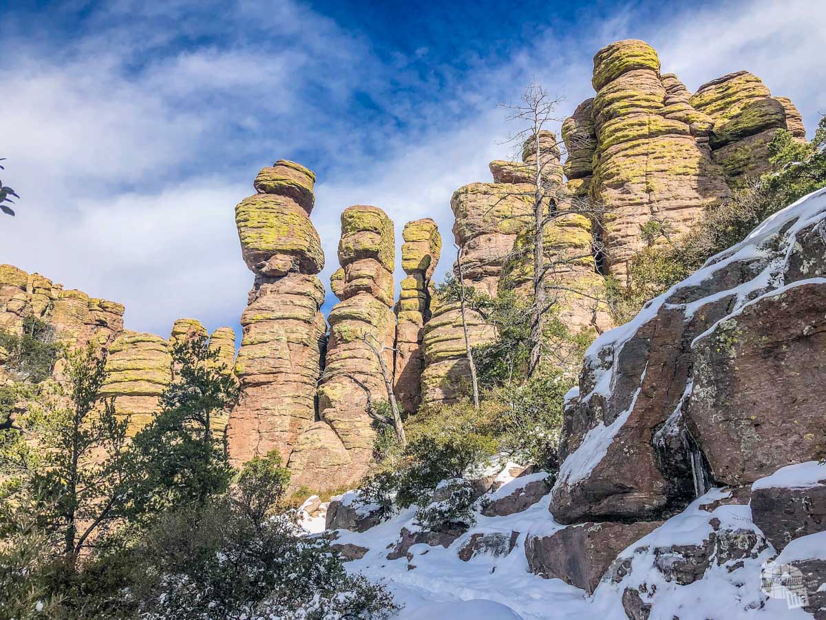
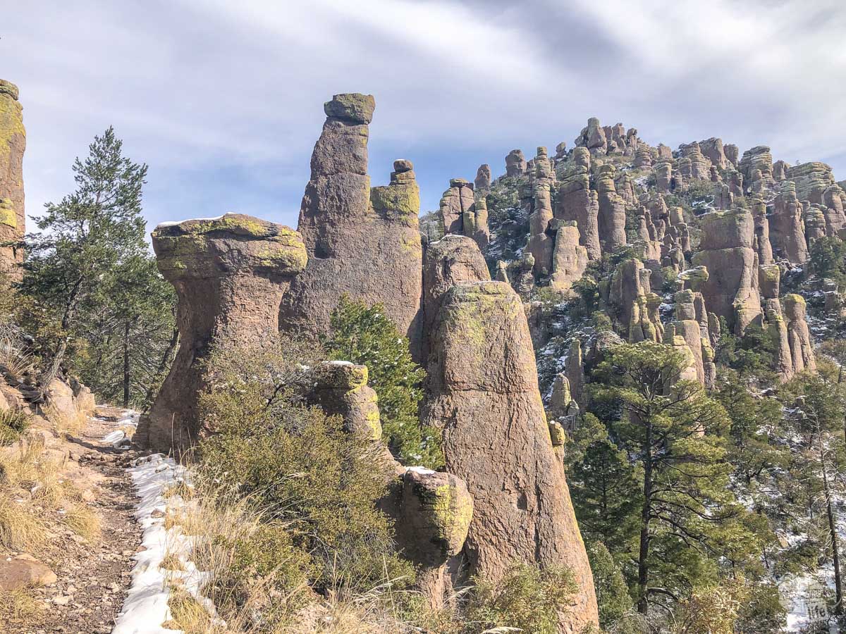
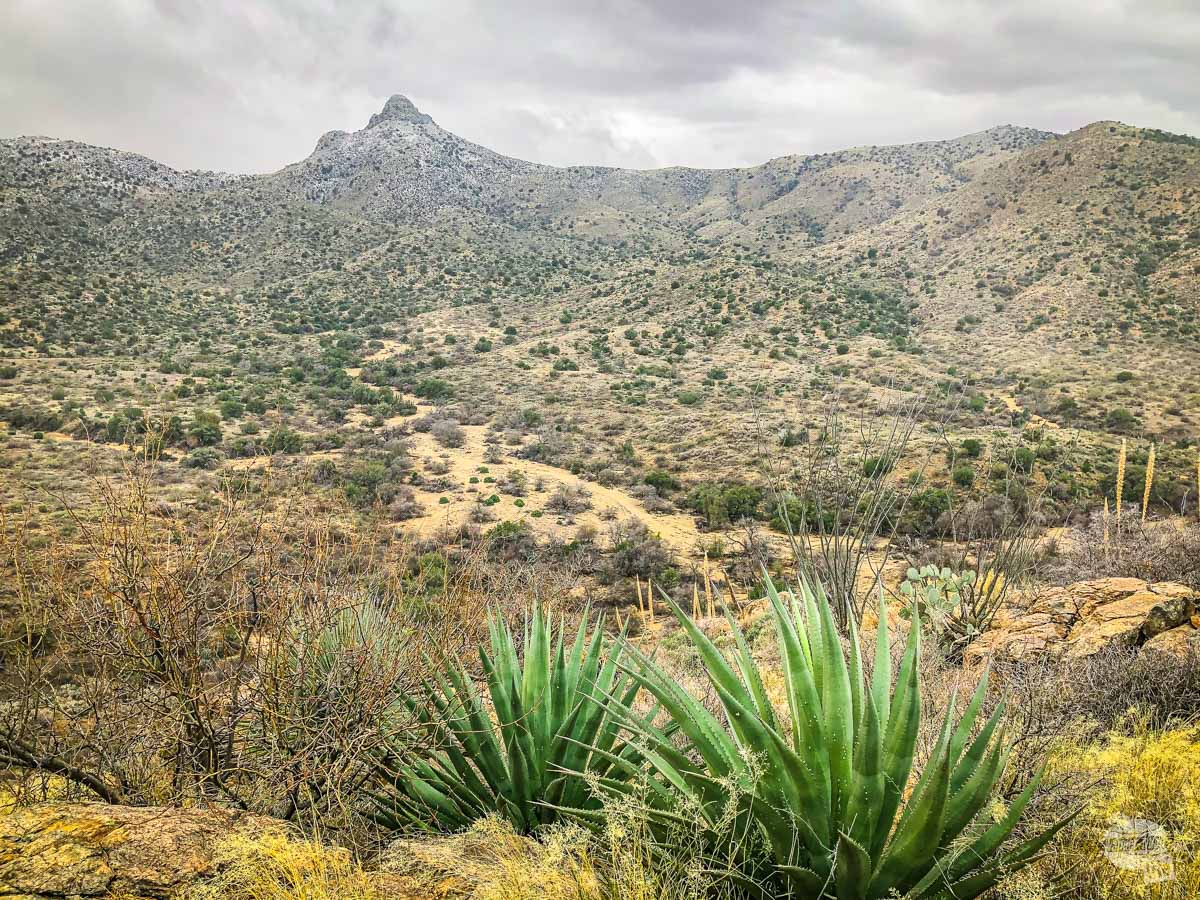
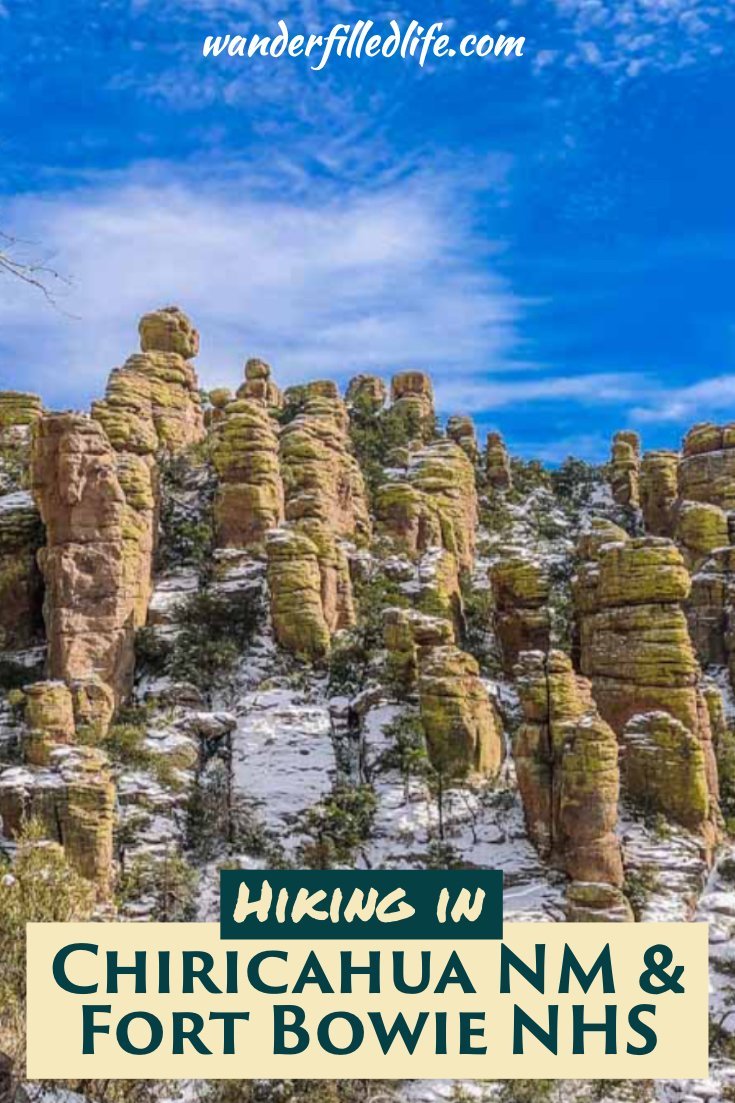
Nestled in the Chiricahua Mountains, this park preserves several canyons with incredible rock formations scattered throughout. Formed by past volcanic eruptions, these rocks form a wonderland you can hike through among the pines and firs.
The Chiricahua Mountains are also a “sky island.” The mountains form an island of vegetation and animals surrounded by a sea of desert grass.
The mountains are also a crossroads for four different biological areas: the Sonoran Desert, the Chihuahuan Desert, the Rocky Mountains and the Sierra Madre Mountains. This makes for some interesting wildlife present in the park, like black bears, coatimundi, javelina, mountain lions and even the very rare jaguar though it’s been around a hundred years since one was spotted.
Getting to Chiricahua National Monument
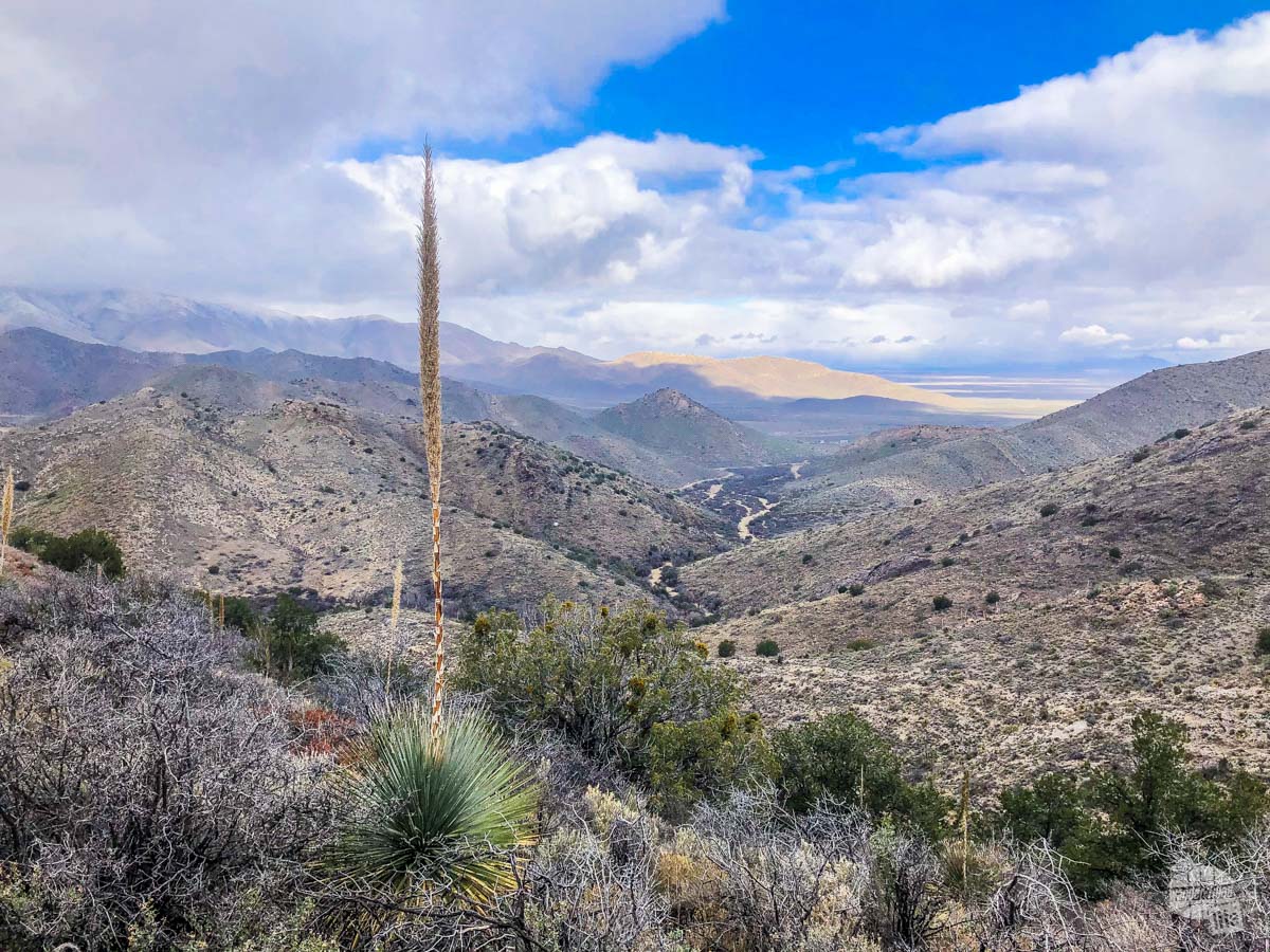
You have to want to go to Chiricahua NM. It is located about 37 miles southeast from Willcox, AZ, which is 83 miles east of Tucson, AZ.
The drive there will take you through miles of ranches and not much else. Seriously, other than the hamlet of Dos Cabezas, you will see very little and there are no services, so make sure you gas up and grab some food before you leave Willcox.
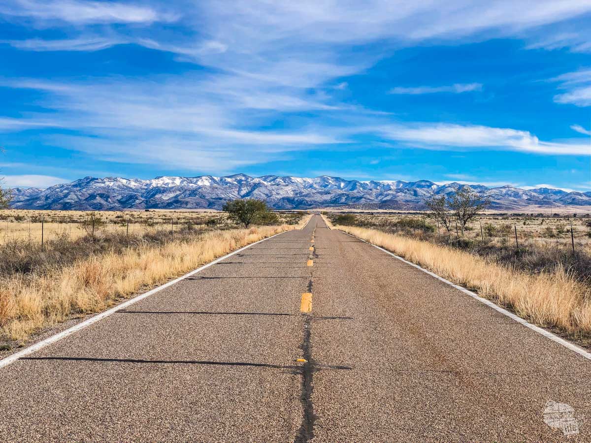
Still, the drive has a certain appeal if you love wide open spaces like we do.
What to do in Chiricahua National Monument
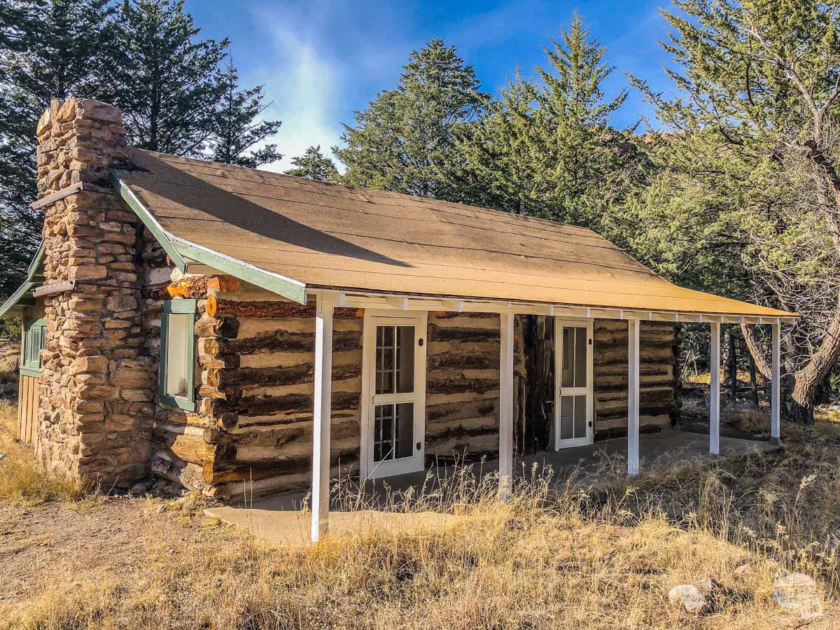
On your way into the park, be sure to stop at the Faraway Ranch and walk out to see the ranch and the Stafford Cabin. It’s about a mile round trip along the valley floor, right along Bonita Creek.
The Faraway Ranch is an old homestead turned into a guest ranch by the Riggs family, who cut trails up into the mountain to take their guests to see the wonderland of rocks.
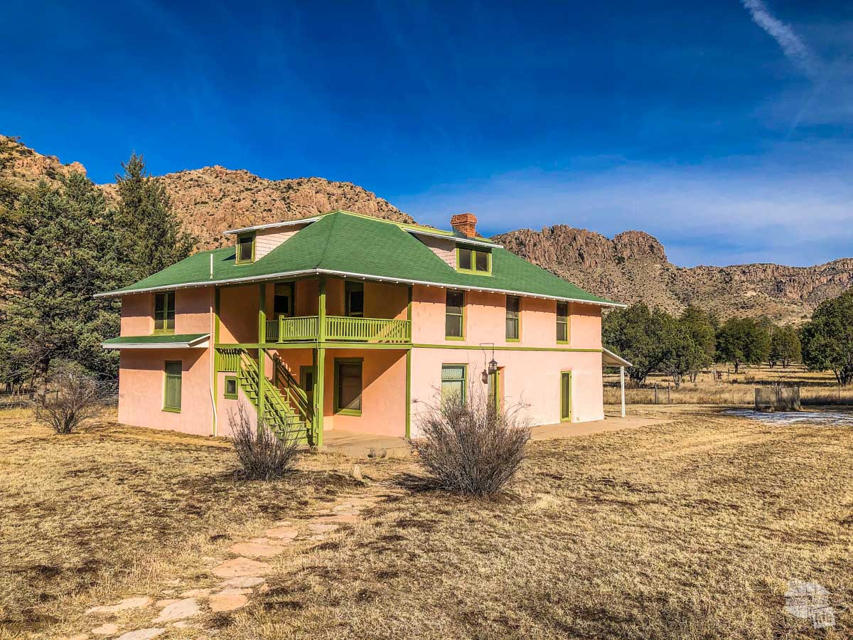
Just past the ranch is the Stafford Cabin, one of the oldest homesteads still standing in southeastern Arizona. The Staffords lived in the cabin for many years until an earthquake damaged the cabin and they sold it to the Riggs to be part of their guest ranch.
This was an easy walk and a perfect introduction to the park.
Be sure to stop at the visitor center as you head further into the park. We always like to watch the movie, check out the exhibits and talk to the rangers about the conditions of the park and what to watch out for on our hike.
For most folks, the highlight of the park is the scenic drive. The eight-mile drive ascends to 6,870 feet at Massai Point. The views are staggering along the drive but the top is more than worth the drive.
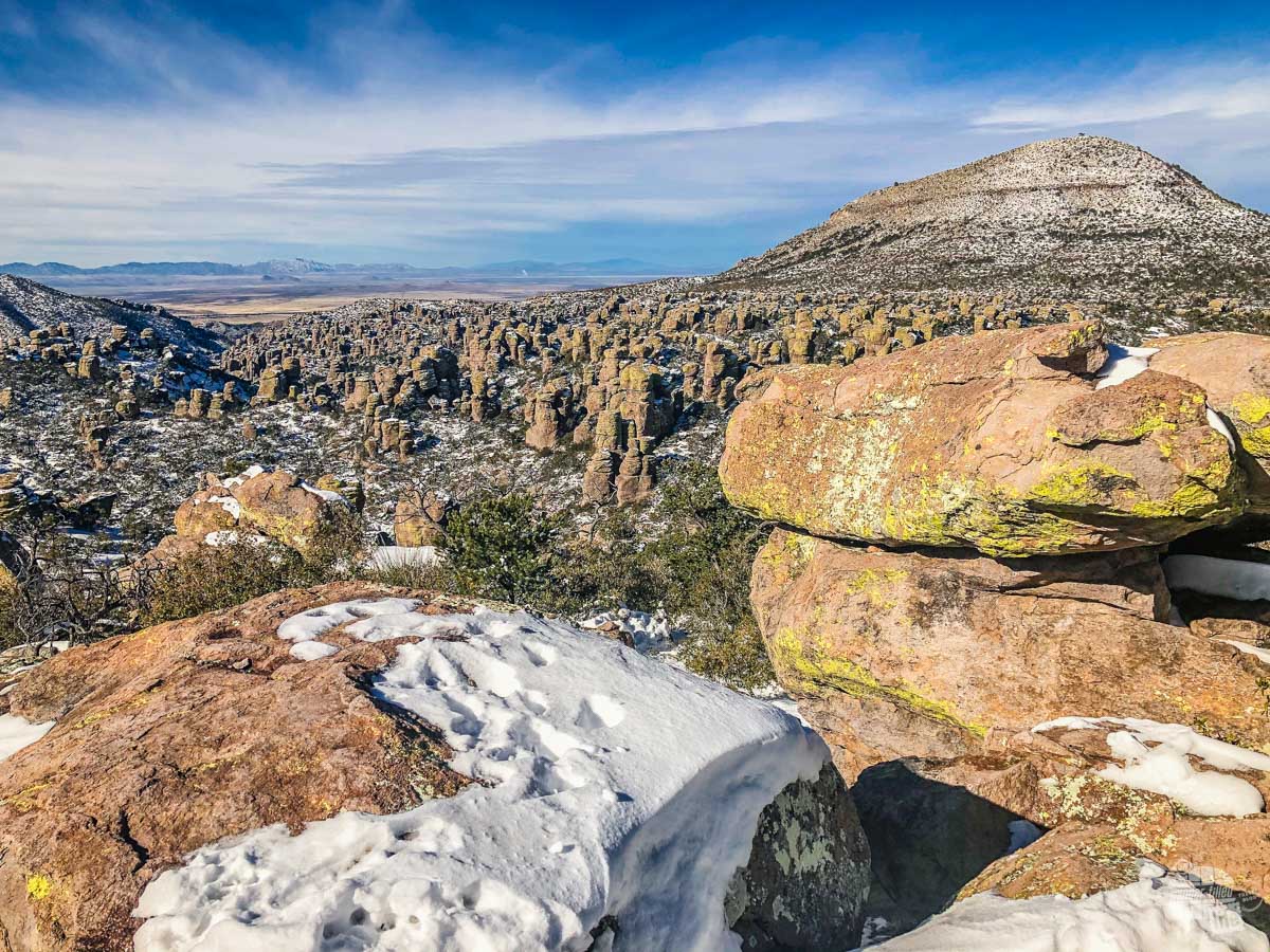
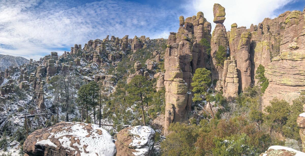
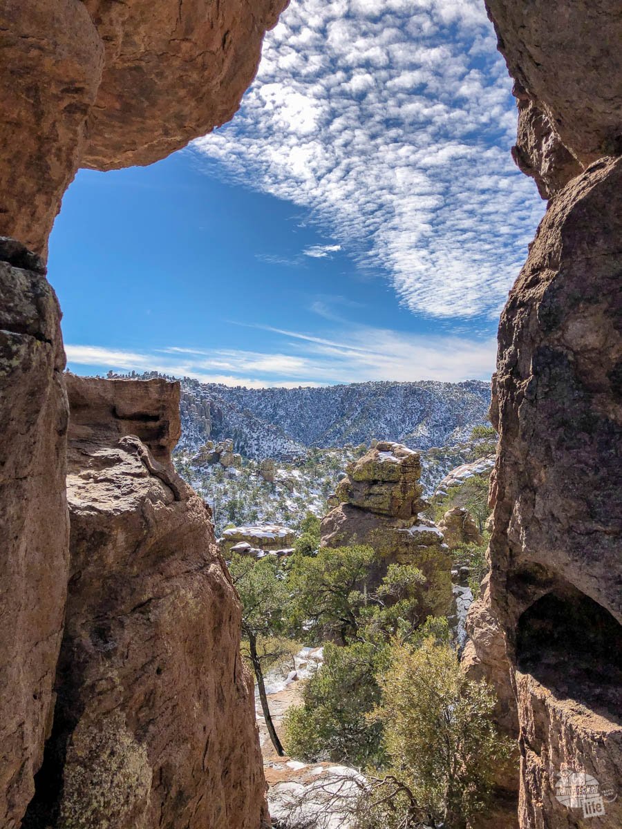
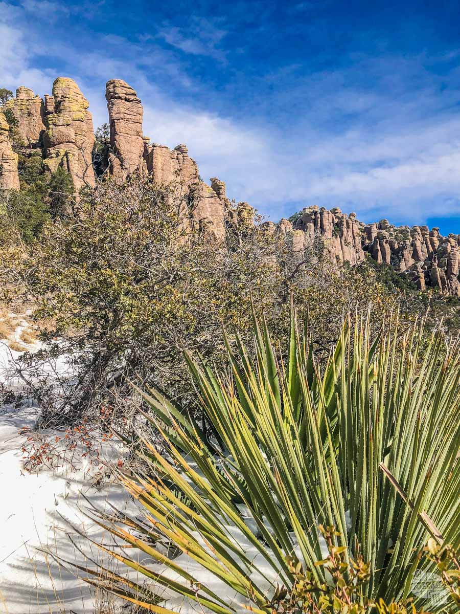
Massai Point provides a 360-degree panorama of Ryholite Canyon, Echo Canyon and Sarah Demming Canyon. You are able to see the massive collections of rock pinnacles, known by the Chiricahua Apache as the “Land of Standing Up Rocks.”
There are a couple of pullouts on the way back down the drive to view some of the more interestingly shaped rock formations.
Hiking Chiricahua National Monument
For us, the biggest attraction at Chiricahua NM is the trails. You can easily spend two to three days hiking the trails here and not get bored.
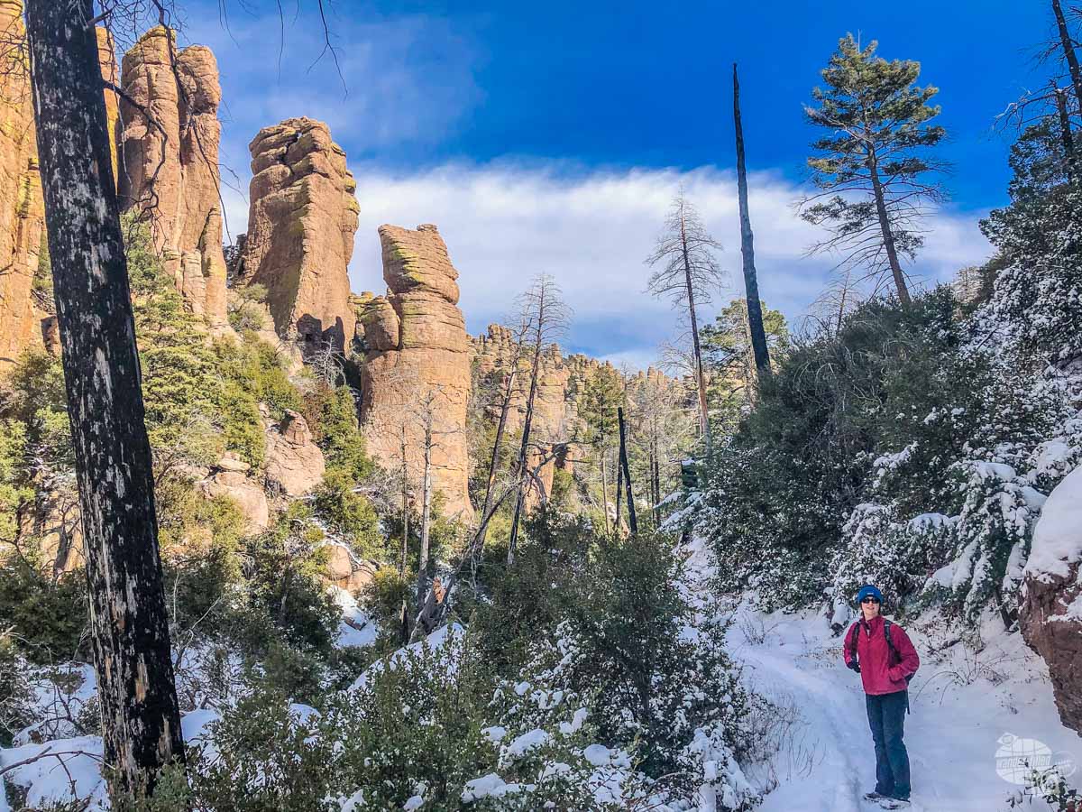
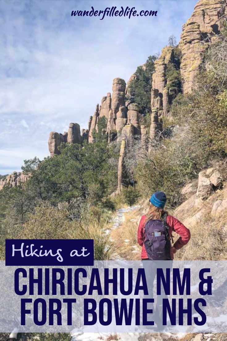
Aside from walking the trail to the Faraway Ranch, we hiked the 3.2-mile Echo Canyon Loop. Normally, the rangers recommend going counter-clockwise on this trail and we can certainly see why. The slope is steeper down than back up going that way and we would recommend that direction.
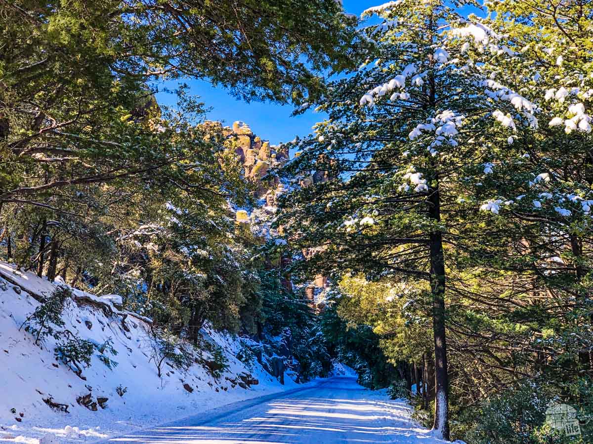
That said, snow fell a couple of days earlier in Chiricahua NM and snow and ice covered the trail. So, the rangers recommended going the opposite direction to avoid slipping in the steep parts and we followed that recommendation.
We followed the gentle downhill of the Ed Riggs Trail through a forest of pine trees framing the pinnacles all around us. As we turned onto the Hailstone Trail, the view opened up to a grand view of the Rhyolite Canyon.
Pro Tip: If hiking in the snow/cold, make sure you dress in layers here. While we were chilly at the trailhead, by the time we got here, we shed our coats. Further along, when we hit the shade again, we put our layers back on.
Check out our 10 essentials for hiking here | Read more about hiking in the winter here
We stopped so many times to take pictures. Honestly, the best views always seemed to be behind us, definitely reinforcing the normal recommendation to hike the trail in the counter-clockwise direction.
It was time for a snack, so we stopped for a moment at the intersection of the Hailstone Trail and the Echo Canyon Trail and just admired the view. We could see the Lower Rhyolite Canyon Trail making its way down to the visitor center in the distance.
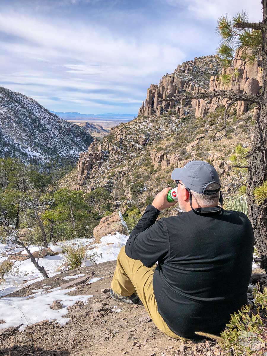
That’s the moment we decided on coming back. We want to catch a ride on the park’s free hiker shuttle back up to the trailhead and hike all the way down to the visitor center. The views are simply that gorgeous.
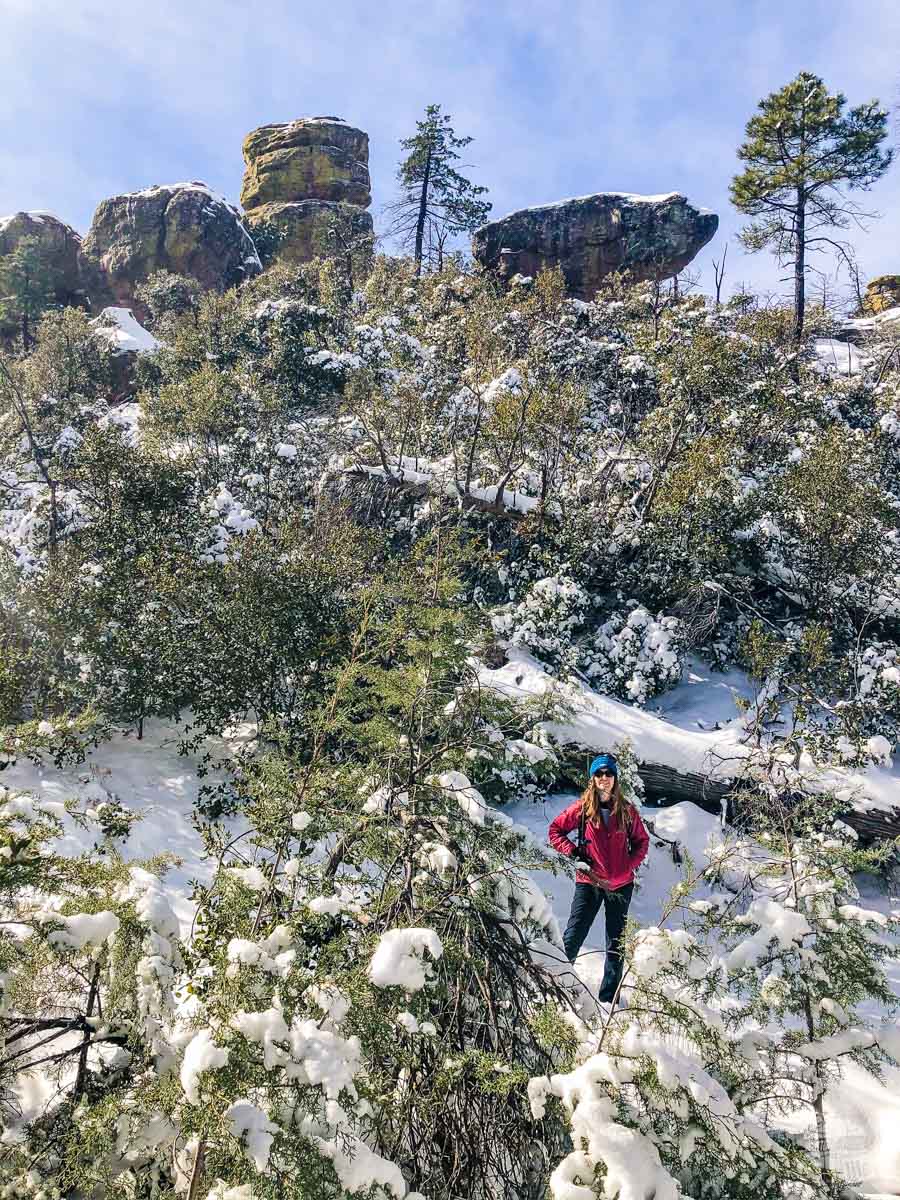
We started up the Echo Canyon Trail and immediately found ourselves immersed in the tight Echo Park, with plenty of trees and Bonita Creek trickling through the ice. As we made our way up to the trailhead, we ascended 450 feet in 1.6 miles, which had us huffing but the views more than made up for the steepness. As we got closer to the top, the trail started winding through slots in the rocks, essentially winding through the pinnacles, making for some great views and framing.
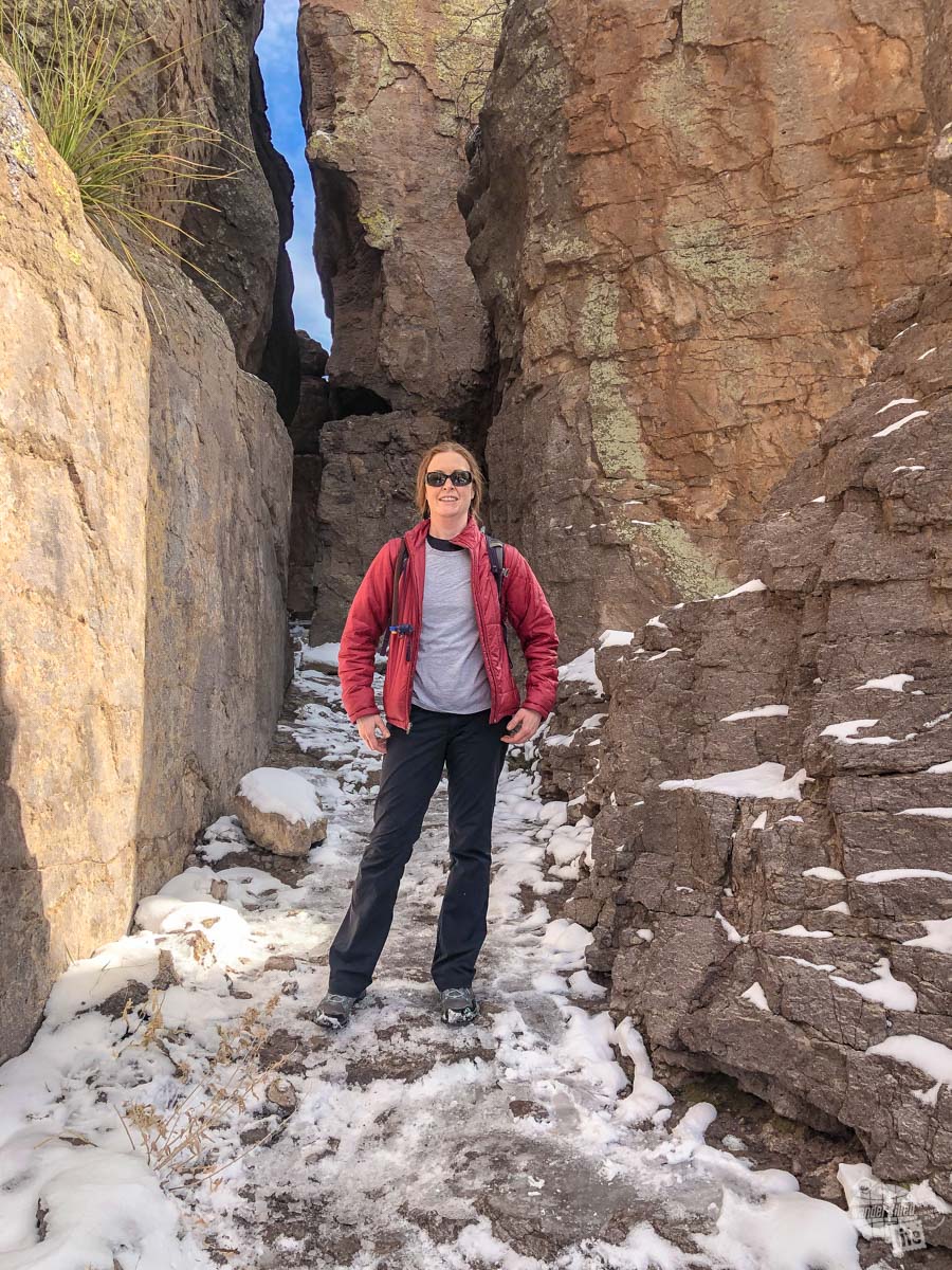
We noticed a lot of thick ice among rocks. Knowing my ability to find a slick spot to slip and fall (like Arches NP in December 2015 and Custer State Park in January 2019), the ranger’s advice rang true.
Still, I want to do the hike again during the spring and see it the “right way,” not to mention the other hikes in the park!
Fort Bowie National Historic Site
Not far from Chiricahua NM is Fort Bowie National Historic Site. Started in 1862 following the Battle of Apache Pass, the Army built the fort to protect the Butterfield Overland Mail route through this essential pass.
What makes this pass so important was Apache Spring, a constant source of fresh water in the desert. For both the Chiricahua Apache and those traveling the stage route, this was an essential source of water.
For years, the Apache and the Butterfield Stage operators existed cooperatively, and the tribe, known for raiding for supplies, only attacked the stage once.
Then came the Bascom Affair in January 1861. A local rancher accused the Chiricahua Apache of raiding his livestock and kidnapping the son of a Mexican woman who lived with him. The government sent the Army to deal with the raid.
The Army commander, Lt. George Bascom, lured the Chiricahua Apache Chief Cochise. He held Cochise hostage until the return of the livestock and boy. Cochise, angry about the false accusation, cut his way out of Bascom’s tent and escaped.
Six months later, as the Army marched through the pass to the water at Apache Spring, the Chiricahua Apache ambushed them, firing on them from above. The Army ended up holding the spring but conflict with Cochise and the Chiricahua Apache and later Geronimo continued for a decade. Fort Bowie served as the hub of the conflict, continuing to secure Apache Pass and Apache Spring.
Getting to Fort Bowie National Historic Site
Fort Bowie NHS is another one of those park sites that require you to really want to get there.
The site is located a bit more than 30 miles from Willcox, AZ or about 13 miles from Bowie, AZ.
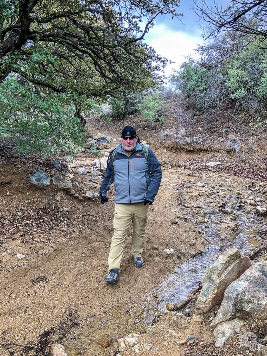
Either way you go, you will have to drive a dirt road to get out to the trailhead. We drove from Bowie and had no problems with the road. We heard that further up the road was a bit more difficult to deal with due to snow.
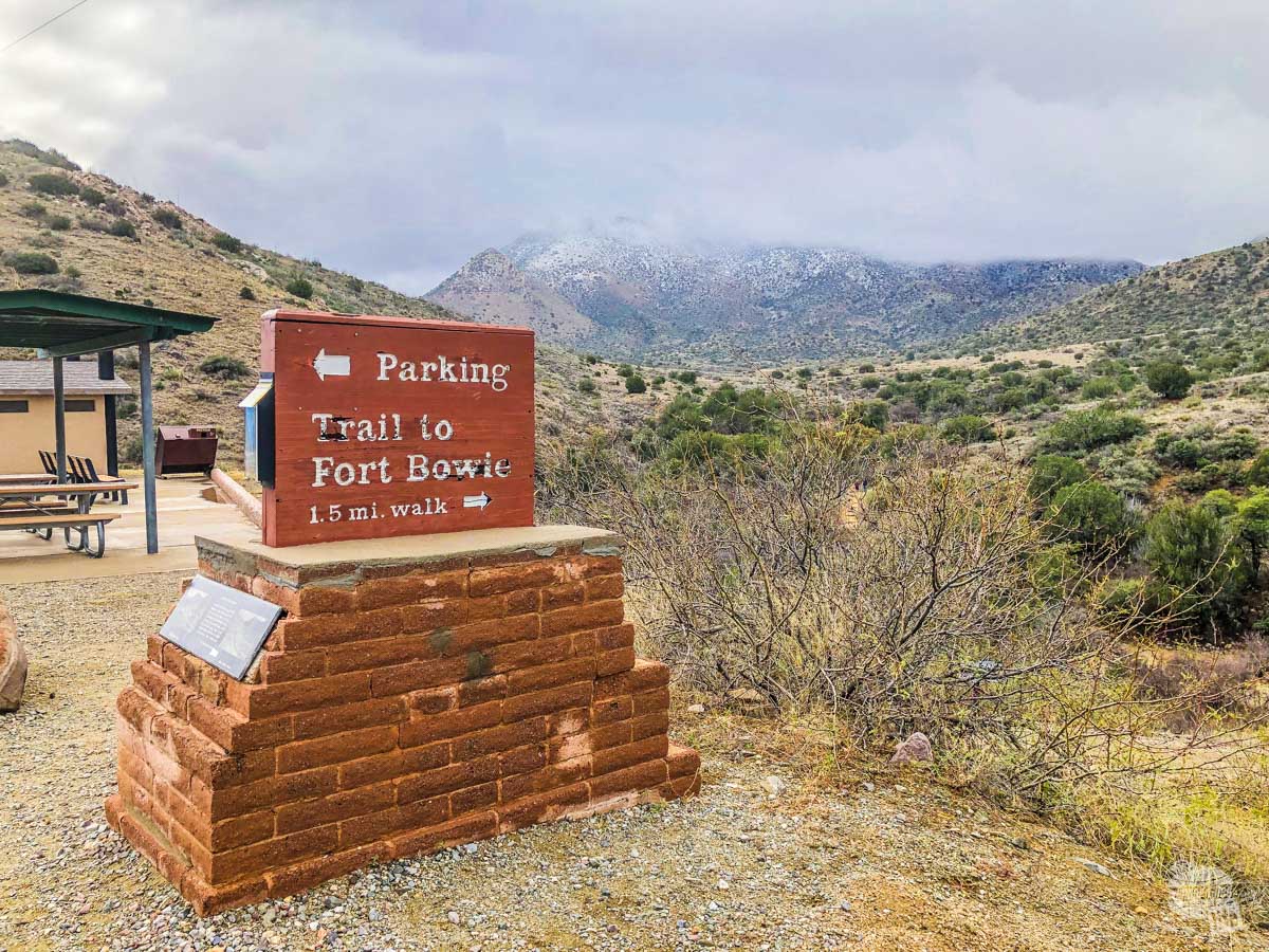
Once you get to the trailhead, it is an easy to moderate 1.5-mile hike to the fort and visitor center. Yes, you read that correctly. You have to hike to get to the visitor center. While most folks should be able to handle the hike, there is a gentle uphill climb as you get close to the visitor center and fort.
Hiking to Fort Bowie National Historic Site
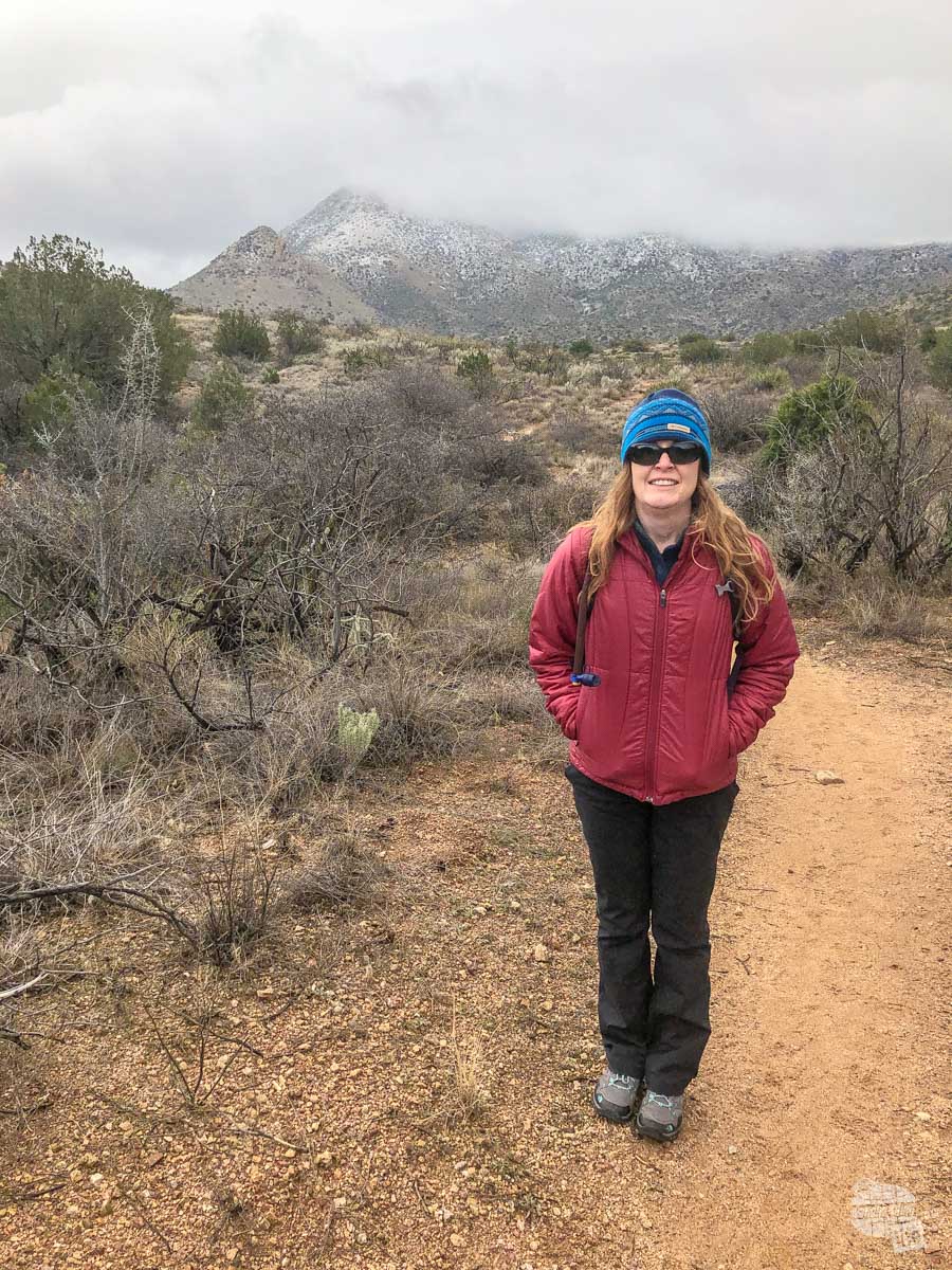
It was a cold, blustery, snowy day when we got to Fort Bowie NHS. We bundled up, grabbed our packs and headed off into the falling snow. Fortunately, it was just warm enough to keep the snow from sticking. Still, it made for a really cool experience.
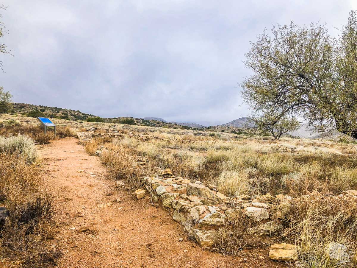
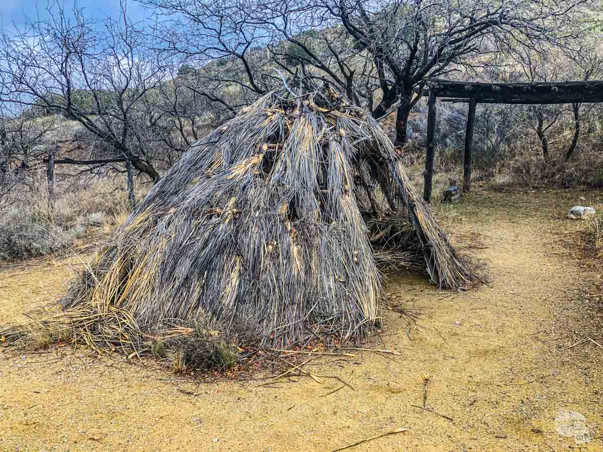
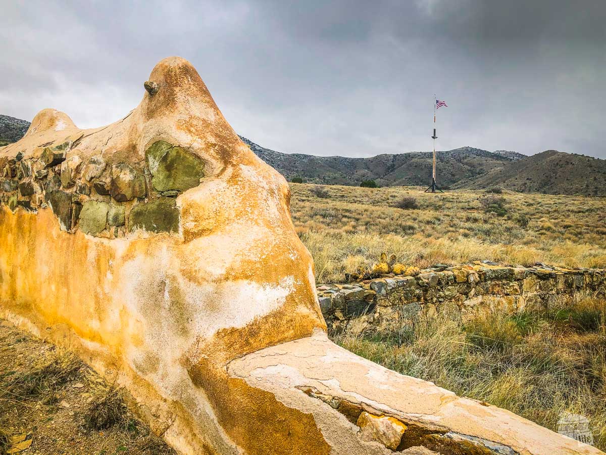
The hike out to the fort is really a hike through the past. The first thing you will pass on the trail is an old miner’s cabin. From there, you will find the old stage station. The park service has interpretive signs all along the way.
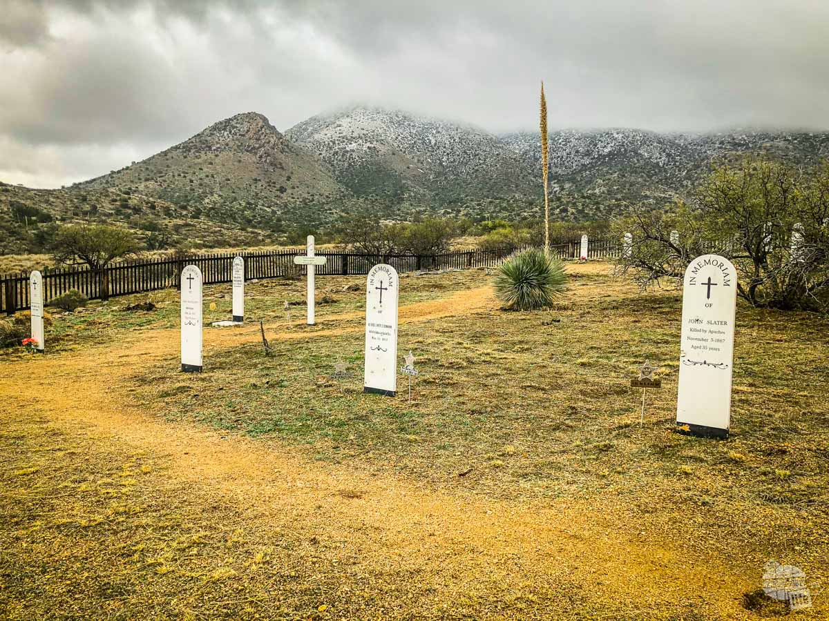
Right by the ruins of the stage station is where Lt. Bascom camped when he confronted Cochise. Just past that is the fort cemetery where several soldiers who died fighting the Chiricahua Apache are buried.
As the trail joins with the spring and follows it uphill, you will come upon the site of the Battle of Apache Pass. The battle was relatively small if you are used to Civil War battles. The battle was significant in terms of the Indians Wars with 138 Union troops coming under fire from around 500 Chiricahua Apache warriors.
The Union forces deployed two artillery pieces which forced the eventual withdraw of the Chiricahua Apache.
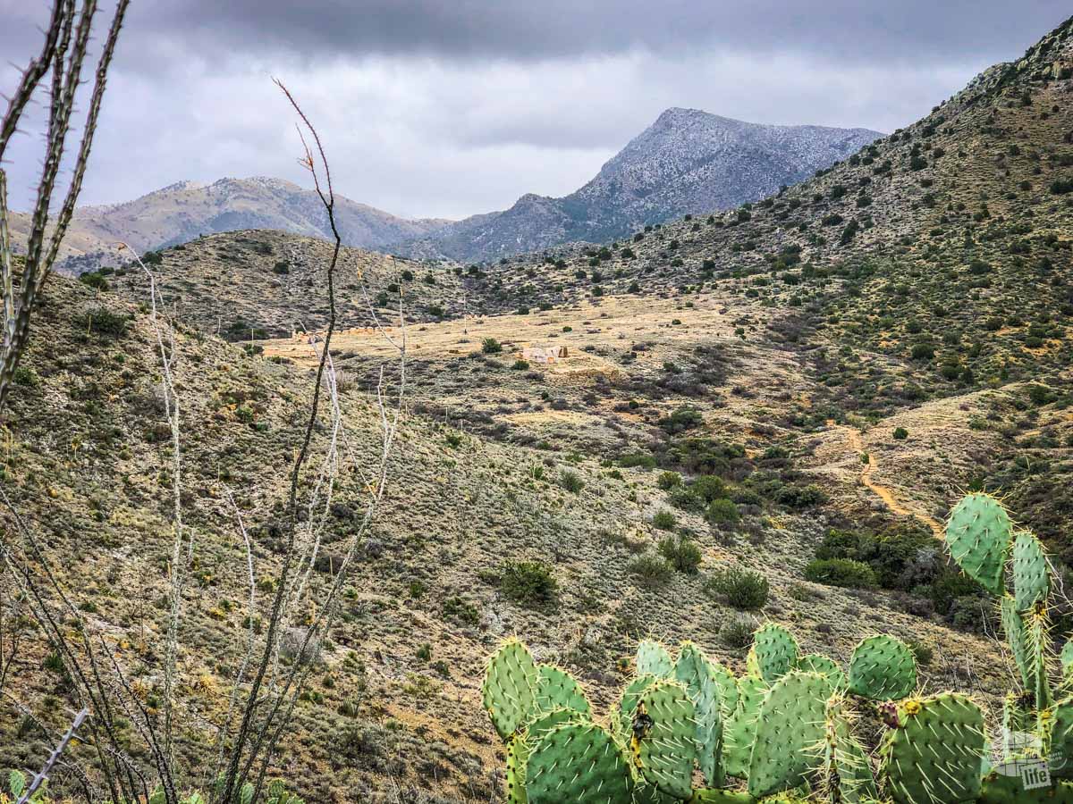
A little further up the trail and you will find the headwaters of the Apache Spring and the ruins of the first fort, which overlooked the spring. From there, it is a short walk up to the visitor center and the ruins of the second fort.
The visitor center has a small bookstore and a few exhibits. The fort, itself, is not much more than the outlined walls of various buildings scattered about the plateau. While you can see the outline of the shape of the buildings, there is not much more than that.
Hiking Back to the Car
While it requires a bit of uphill from the visitor center, be sure to take the Overlook Ridge Trail back to the parking lot.
As you hike up the ridge, if you turn back, you will be rewarded with the best views of the fort and the Chiricahua Mountains.
As you continue along the ridge, there is a spur trail that will take you to the overlook. This is where the Chiricahua Apache hid, firing upon the soldiers during the battle.
The trail switches back and forth down from the ridge, bottoming out at the Butterfield Overland Mail stage road. The trail then reconnects with the main trail back to the parking lot.
A word of warning: this trail crosses both a wash and a creek bed. Both of them can easily flood in a rain. Be wary.
Where to Stay When Visiting Chiricuahua and Fort Bowie
We stayed at the Hampton Inn in Lordsburg, NM for four days. It served as a central location for visiting these two sites and Gila Cliff Dwellings National Monument. The hotel was only 10,000 points per night, making it a decent spot for a reward stay from a points perspective.
Read Trip Advisor Reviews | Book It
That said, we cannot recommend staying in Lordsburg for anything more than one night. Quite simply, there’s not much in the way of places to eat and what is there isn’t that good.
If we had the ability to do this trip over again, we would have stayed in Willcox, AZ while visiting Chiricahua NM and Fort Bowie NHS. While there wasn’t a Hilton property in town, there were several decent hotels in town plus a good number of restaurants.
We also saw a few decent-looking RV campgrounds in Willcox but can’t attest to their quality. Other than Bonita Creek campground in Chiricuahua NM, which can only accommodate tents and small RVs, there is nowhere else nearby to stay.
I wish I could recommend a place to eat around here but I simply can’t recommend anything we tried in Lordsburg.
Final Thoughts on Chiricauahua and Fort Bowie
We had a lot of fun visiting these two sites. Seeing snow in the desert made for a cool, unique experience. We really enjoy getting off the beaten path and getting to these two sites certainly required it.
I love that Fort Bowie NHS requires a hike to get out to it. We learned a lot about the site on that hike before we even got to the visitor center. Hiking in the falling snow/sleet was a bonus.
Chiricahua NM, though, stole our hearts. The area is called the “Wonderland of Rocks” and we can certainly see why. Our hike through the snow here was one of the most fun things we have ever done.
We are so excited to return here some spring in the future to hike more of the park. This site just joined our list of National Parks Hidden Gems. It’s that good.
Travel Resources
What do you use to find a flight?
We use Skyscanner to find deals on flights. Skyscanner has a great interface and compares tons of airlines for the best pricing and routing. That said, it does not always have every airline and some airlines will have better deals on their website. Still, Skyscanner is a great place to start.
Click here to search for a flight.
What do you use to find a hotel?
We typically stay at Hilton properties, so we use the Hilton website. You can find good Hilton Honors discounts or AAA discounts for a hotel there. We make great use of our free night certificates from our Hilton Honors American Express.
Click here to book a Hilton property.
If there are no Hilton properties available, we use TripAdvisor to read reviews and book the hotel. We find we can get the best price that way.
Click here to search for a hotel.
We recently partnered with Stay22 to add interactive maps to each of our destination posts. This will allow you to see a plethora of hotels and vacation rentals all in one responsive map of the area.
What if I need more space than I can get at a hotel?
We use Vrbo for the times when we have rented a cabin for a weekend getaway, like this cabin in Townsend, TN, or needed to rent a house for a large family vacation. We had a great experience with them in terms of refunding deposits when COVID hit and will continue to use them.
Click here to search for a vacation rental.
Who do you use for rental cars?
As a general rule, we book with Hertz for rental cars. We have had nothing but good experiences with them. Plus, we really like unlimited mileage and not worrying about crossing state lines. We have even rented from Hertz overseas in both Slovenia and Croatia.
Click here to book a rental car.
How about booking a cruise?
We have found some amazing prices for booking a cruise through Cruise Direct. We have saved a lot of money on our cruises compared to what we found elsewhere, making a last-minute Bahamas cruise even cheaper.
Click here to book a cruise.
What if I want to rent an RV?
We highly recommend Outdoorsy for RV rentals. We rented a camper van for a week to visit Rocky Mountain National Park for the elk rut and Custer State Park for the Buffalo Round-Up and had a blast. The program was easy to use and we really enjoyed the freedom of having a camper van for that trip.
Click here to rent an RV.
What do you use for booking tours?
We don’t often book tours. Typically, we like to do stuff on our own. That said, there are some experiences you can’t have any other way. So, when we do want to book a tour, we always check Viator first.
Click here to book a tour.
Do you use anything to get discounts on the road?
We make extensive use of both Good Sam and AAA on the road. Good Sam is normally regarded as a discount card for RVers at campgrounds and Camping World but anyone can use the 5 cents off a gallon at the pump at both Pilot and Flying J.
Click here to get a Good Sam membership.
We have had AAA as long as we have been married and it has more than paid for itself in discounts at hotels, aside from the peace of mind of having roadside assistance. Add in paper maps and the ability to get an international driver’s license and it is more than worth it for any traveler out there.
Click here to get a AAA membership.
Great collection, looking fwd to hear more on SE AZ
Thanks! It’s a neat area and we are looking forward to going back to explore more!
Hi Grant and Bonnie loved the read and tips! Thank you for sharing your experince – beautiful pictures too!
Thank you! We loved Chiricahua NM and hope to return when it’s warmer to do more exploring!