Last Updated on February 22, 2024 by Grant
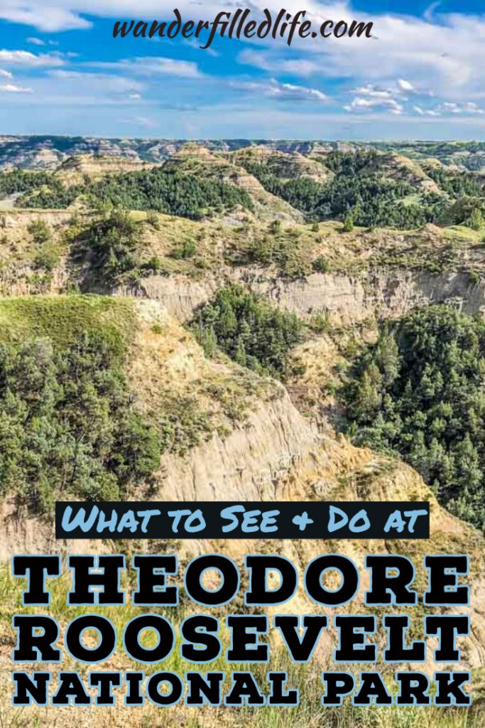
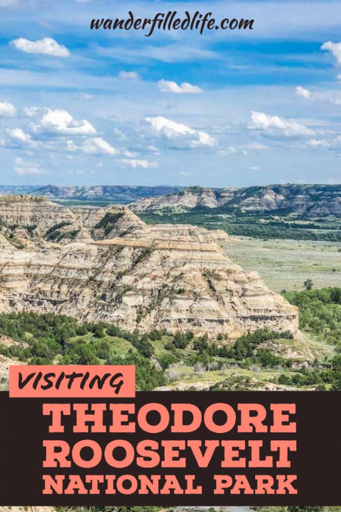
When we said we were visiting Theodore Roosevelt National Park this summer, most folks said, “Where?” True, it is not the most popular or well-known park and the North Dakota badlands that comprise the park are not the towering cliffs of Yosemite or the geysers of Yellowstone. But there is a reason Theodore Roosevelt fell in love with this place.
Roosevelt first came here to hunt bison. On that trip, the rugged landscape and the equally rugged people who settled this land captured his imagination and heart. He invested in a cattle ranch, the Maltese Cross Ranch, near Medora. Following the death of his mother and wife on the same day, he returned to North Dakota to heal. He started a second ranch, the Elkhorn Ranch, north of Medora and built a cabin there.
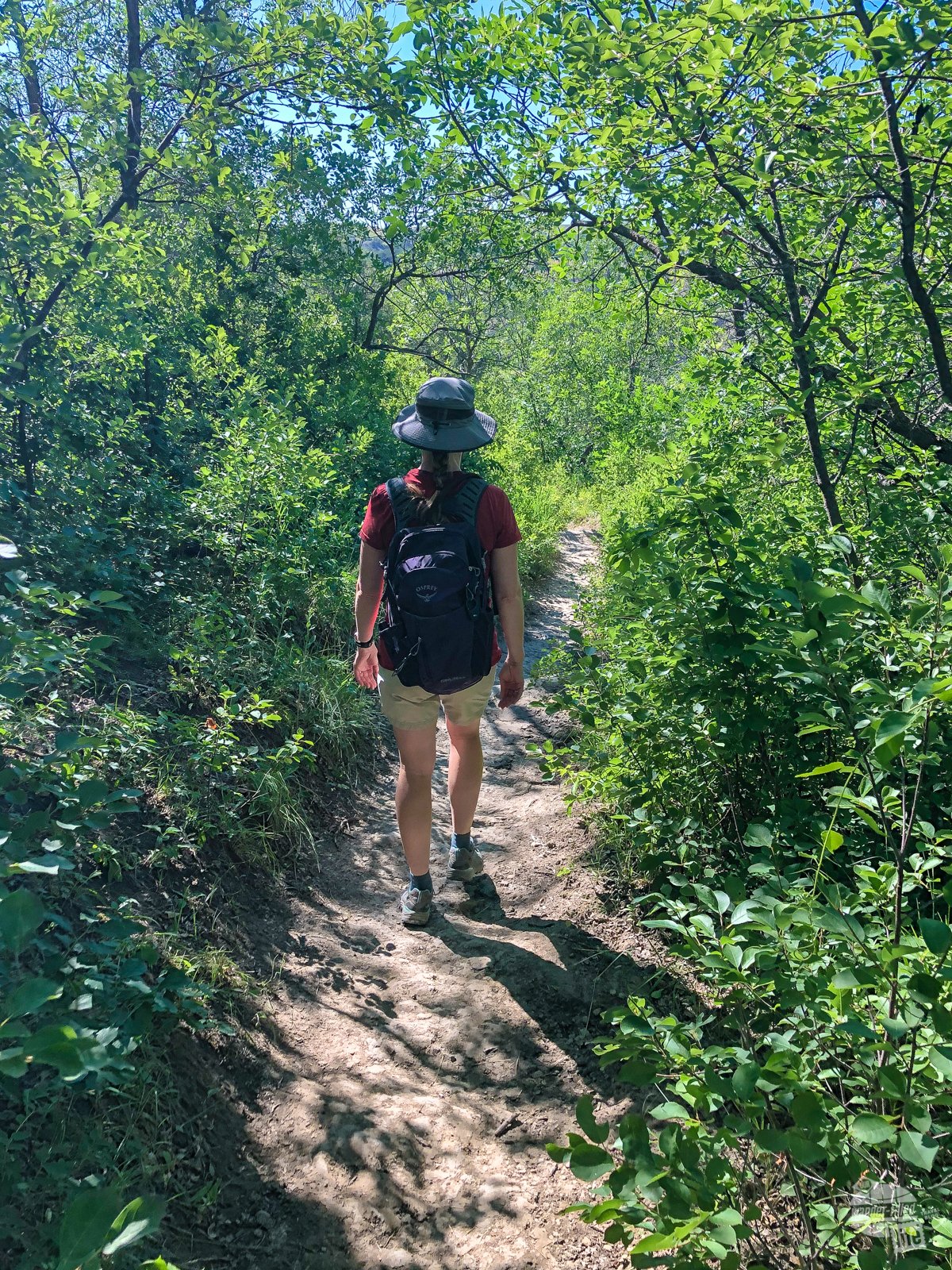
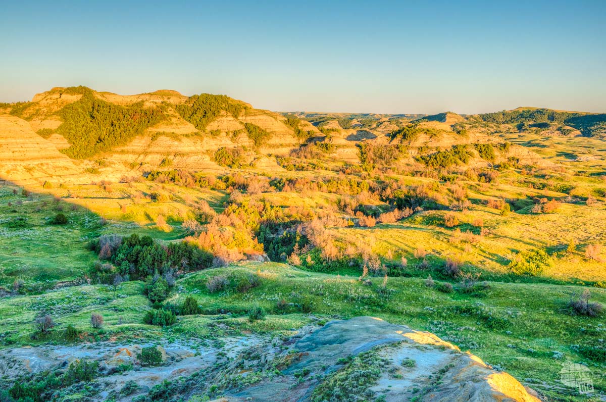
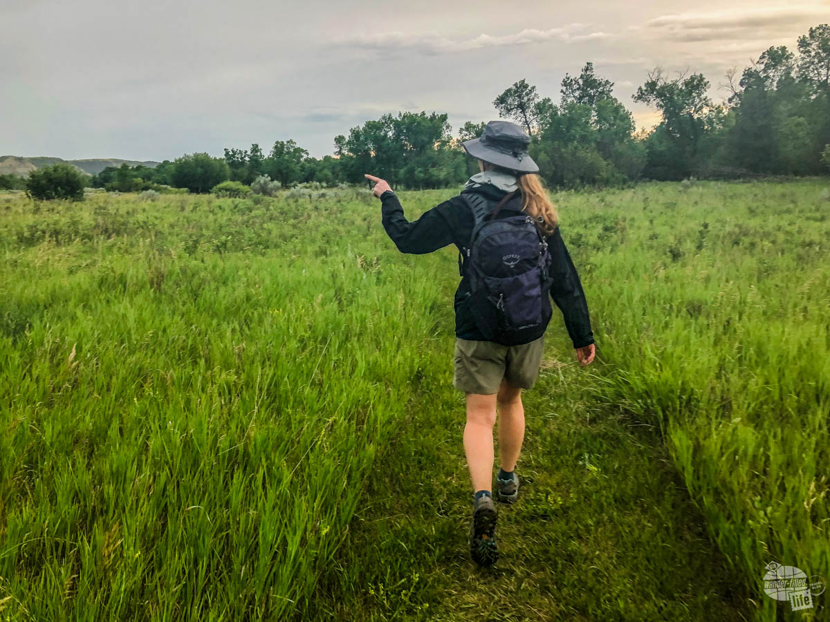
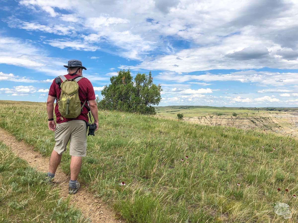
Seeing this rugged landscape, you can quickly see why Roosevelt fell in love with this area. All it takes is a few minutes’ walk to get away from the park roads and you are surrounded by the sounds of nature. It’s a truly magical place.
(Disclaimer: When we link to places where you can buy our stuff or places we stayed, we are using special codes that earn us commissions on the sales at no additional cost to you. Please see our Review Policy for more information.)
The Basics of Visiting Theodore Roosevelt National Park
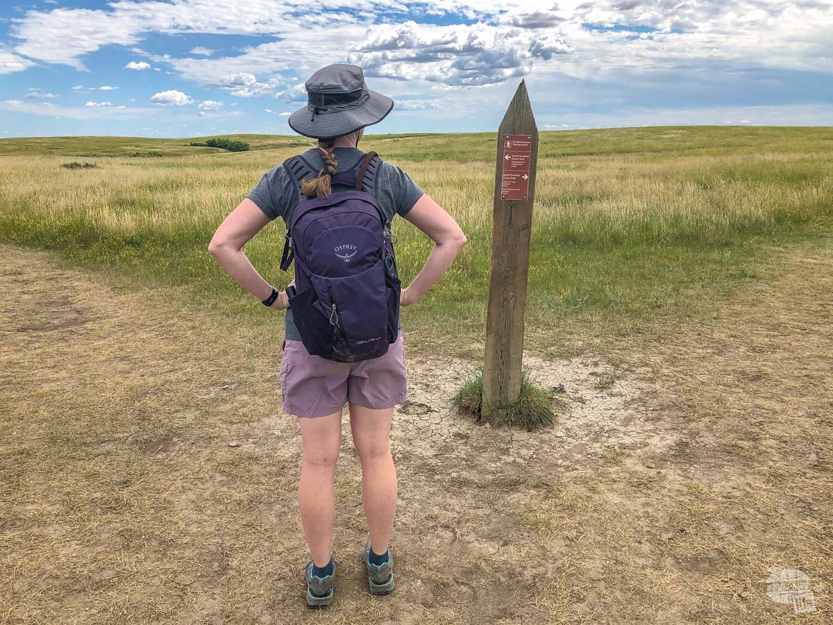
Theodore Roosevelt National Park consists of three units located in southwest North Dakota: the North Unit, located south of Watford City, the South Unit, located north of Medora, and the Elkhorn Ranch, which is located between the north and south units off a dirt road.
The South Unit is almost twice as large and is more developed than the North Unit. That is fitting because the South Unit gets a lot more traffic due to its proximity to Interstate 94 and Medora.
The North Unit is located 68 miles north of the South Unit and it takes nearly 1.5 hours to get there from Medora.
The Elkhorn Ranch is a small site that consists of a trail out to the site where Roosevelt had his cabin. Getting here takes a bit of doing. This unit is located off gravel roads that wash out easily in storms. Be sure to get directions and road conditions from the visitor center before heading out.
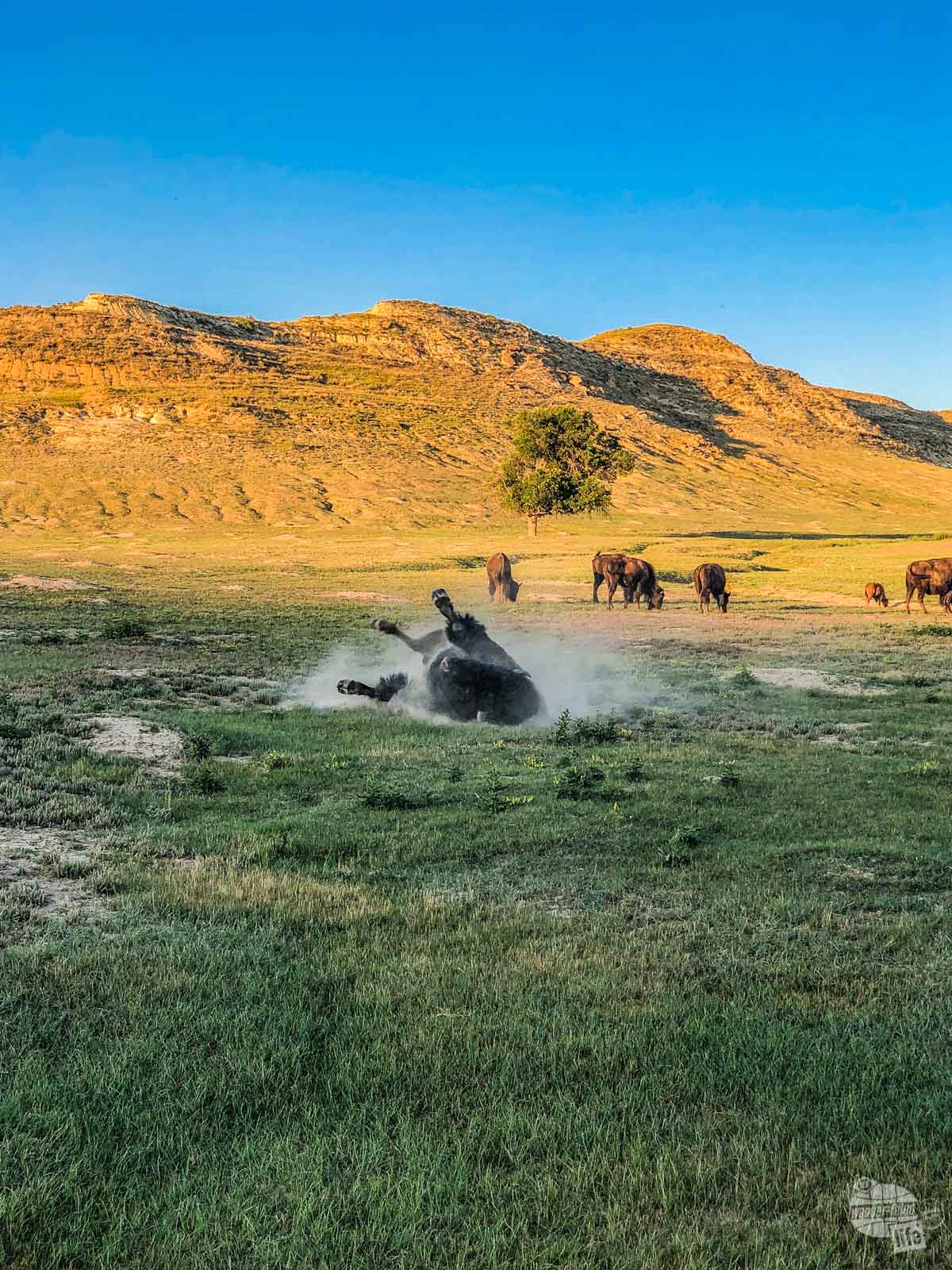
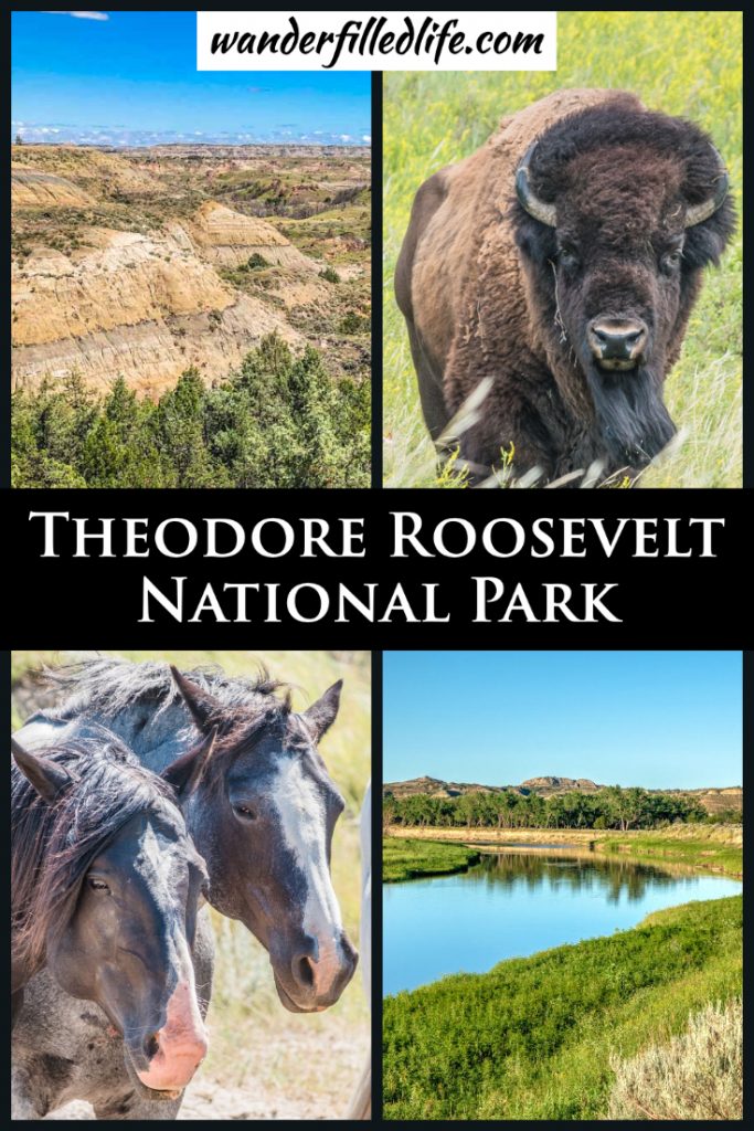
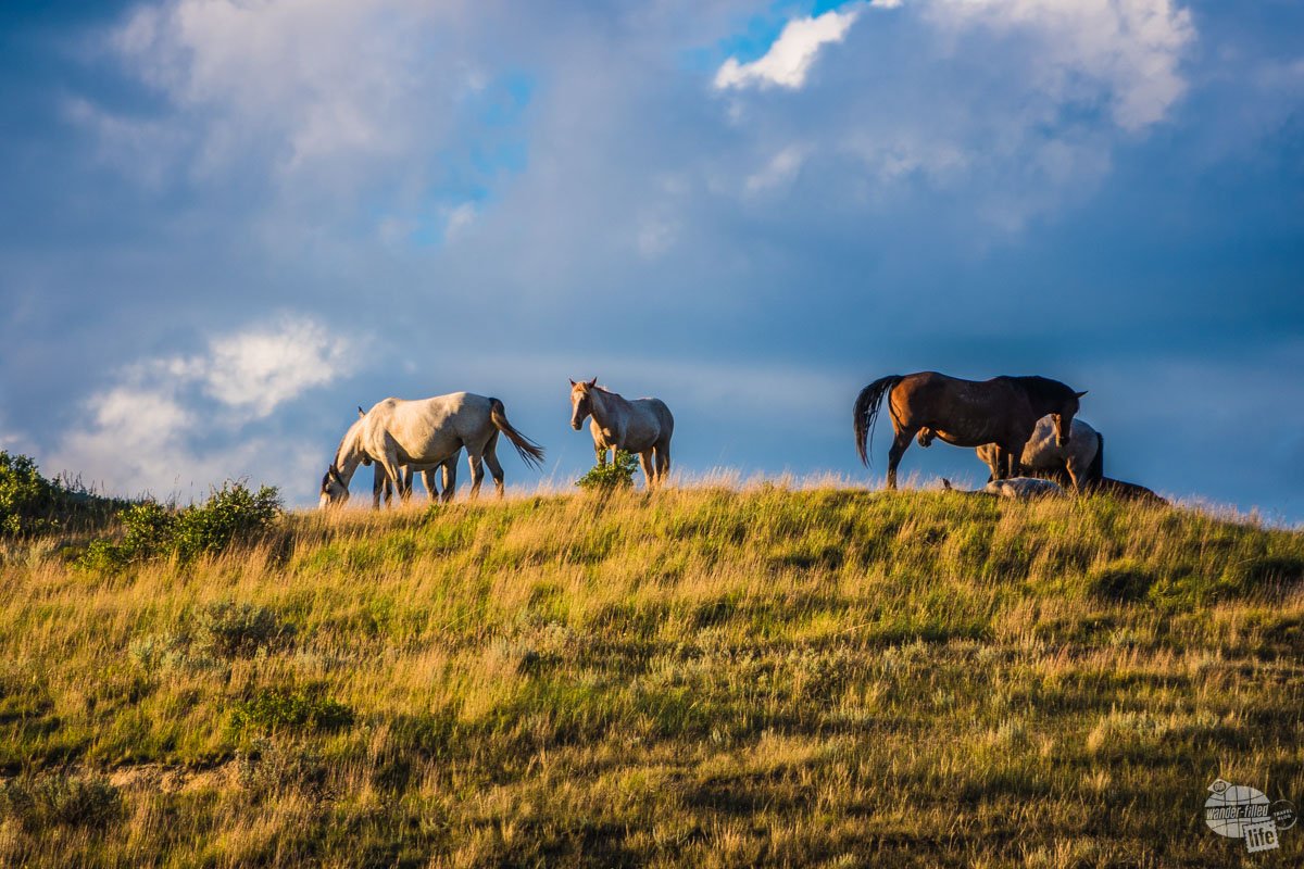
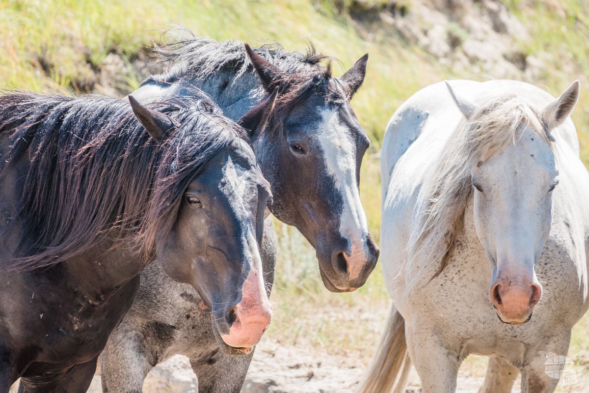
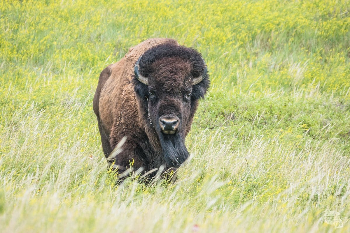
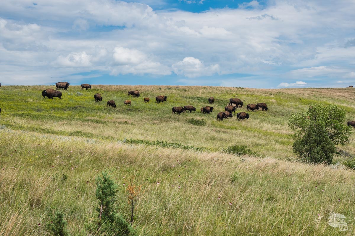
You can find a plethora of wildlife in the park, most notably bison and wild horses. There are elk here as well and while we didn’t see any in the park, we did see a couple near Medora. You can also find Bighorn sheep and Longhorn steers in the North Unit.
One oddity about the park: the North Unit is located in the Central Time Zone and the South Unit is located in the Mountain Time Zone.
Visiting the South Unit of Theodore Roosevelt National Park
Painted Canyon Visitor Center
The vast majority of visitors to this park stop at the Painted Canyon Visitor Center, which is, basically, an Interstate rest stop. I-94 comprises the southern border of most of the South Unit.
This visitor center offers some really pretty views and a couple of nice trails, which makes for a great break when you are driving. We hiked the Painted Canyon Nature Trail, an easy-moderate 1-mile loop trail.
Surprisingly, this trail had a bit of shade (rare for this park) and while the uphill coming back up is a little steep, it’s nothing to worry about it.
In all, if you have time for nothing else, this is a quick way to see a snippet of this amazing park.
Check out our 10 essentials for hiking here.
Exploring the Scenic Loop Drive
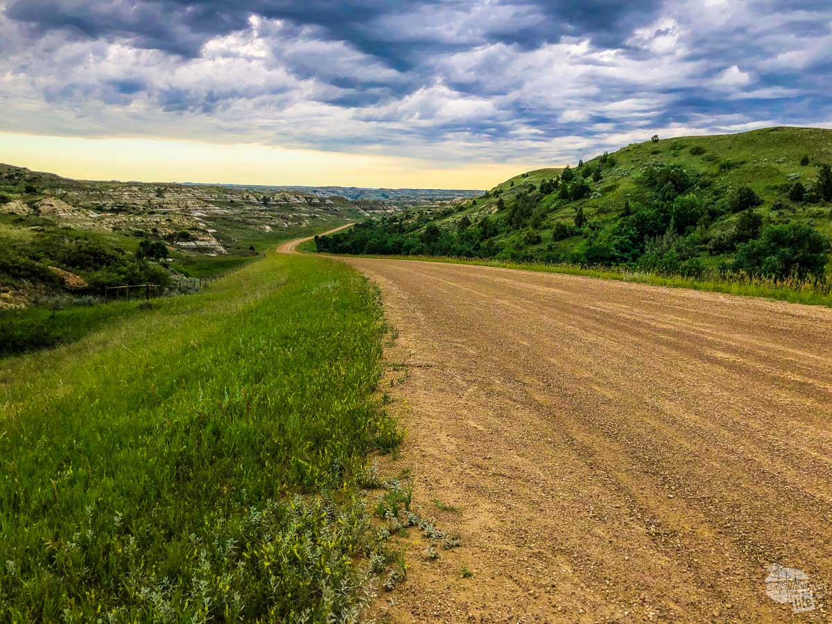
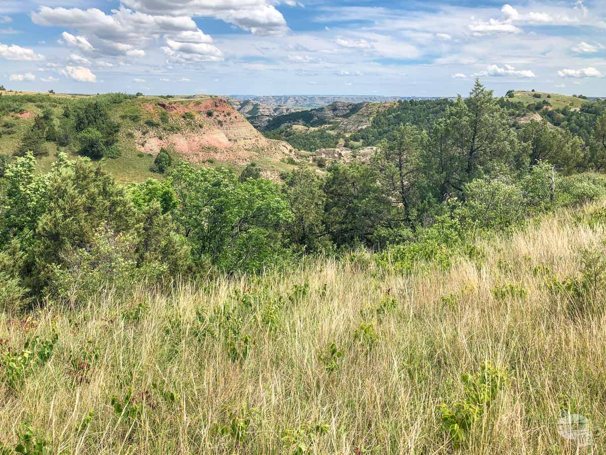
The main attraction of the South Unit is the Scenic Drive, a 36-mile loop through this part of the park. The drive is gorgeous, with ample spots to get out and explore.
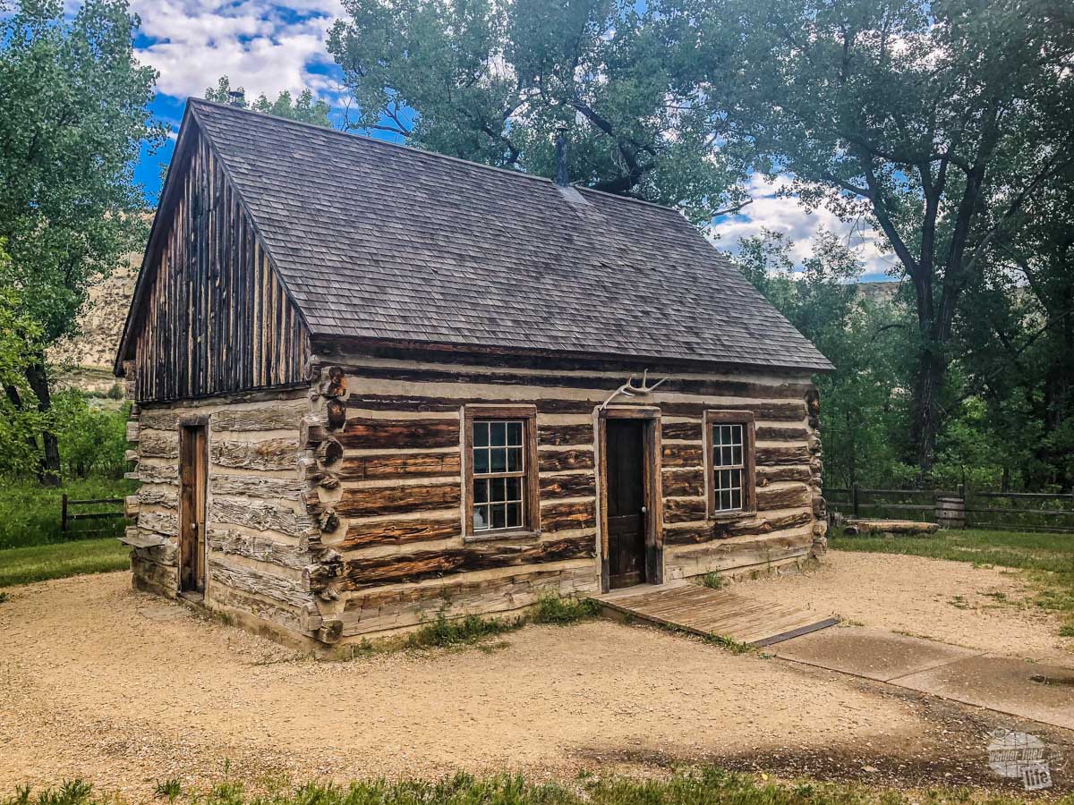
Driving into the park, your first stop should be the main Visitor Center. Here you will learn more about the history and geology of the park. Right behind the visitor center is Roosevelt’s Maltese Cross Cabin, the cabin from his first ranch in North Dakota.
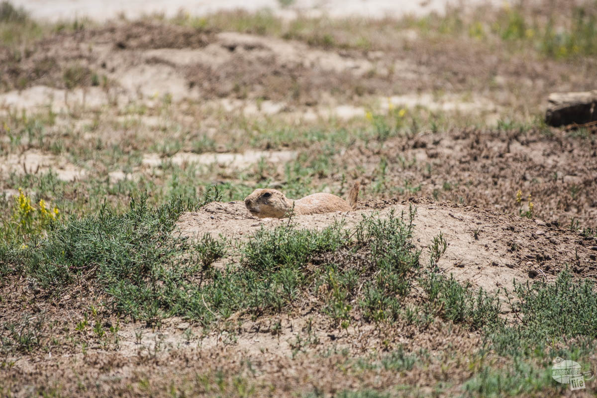
Past that, the road begins to ascend up to the Medora Overlook, which has nice views of the town, and then across I-94. At that point, you are in the South Unit proper. As you follow the road, you will encounter the first of several prairie dog towns. If you have never spent any time watching prairie dogs, this is a good spot with plenty of parking that will allow you to watch these cool critters as they scatter about, chirping and barking.
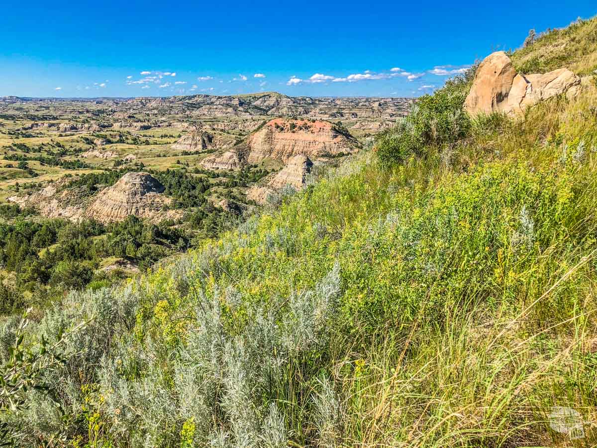
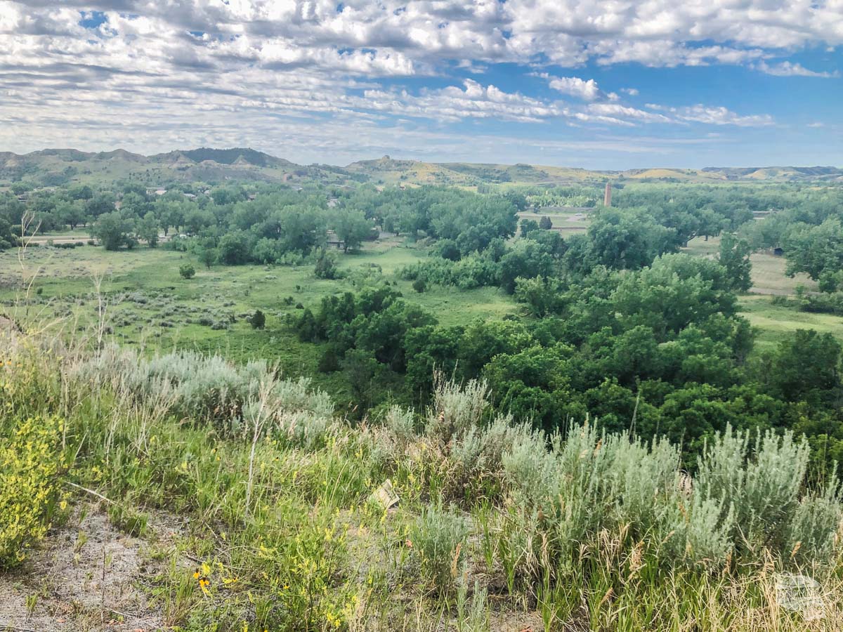
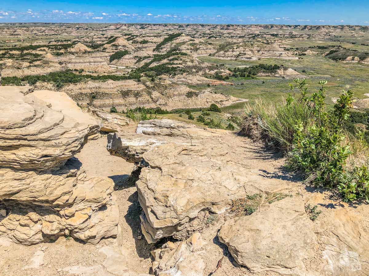
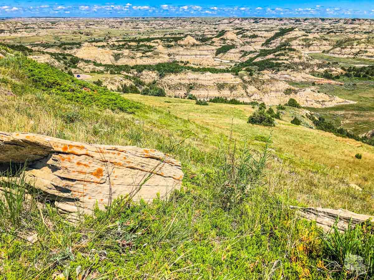
Beyond that is the Skyline Vista, a staggering view of the North Dakota badlands. It is also a good place to park a trailer if you are towing one. Unfortunately, the scenic drive has a four-mile section closed presently due to erosion. The Park Service is waiting on funding to repair this road so it might take a while before it is fixed. There are only a couple of turnarounds for large vehicles, so be sure to talk to the rangers if you are driving or towing your camper.
Since the road had a closed section, we decided to drive to the far end, the Badlands Overlook, and slowly work our way back. This allowed us to just enjoy the drive out and worry about turnouts, hikes, etc. on the way back.
Badlands Overlook and Old East Entrance Station
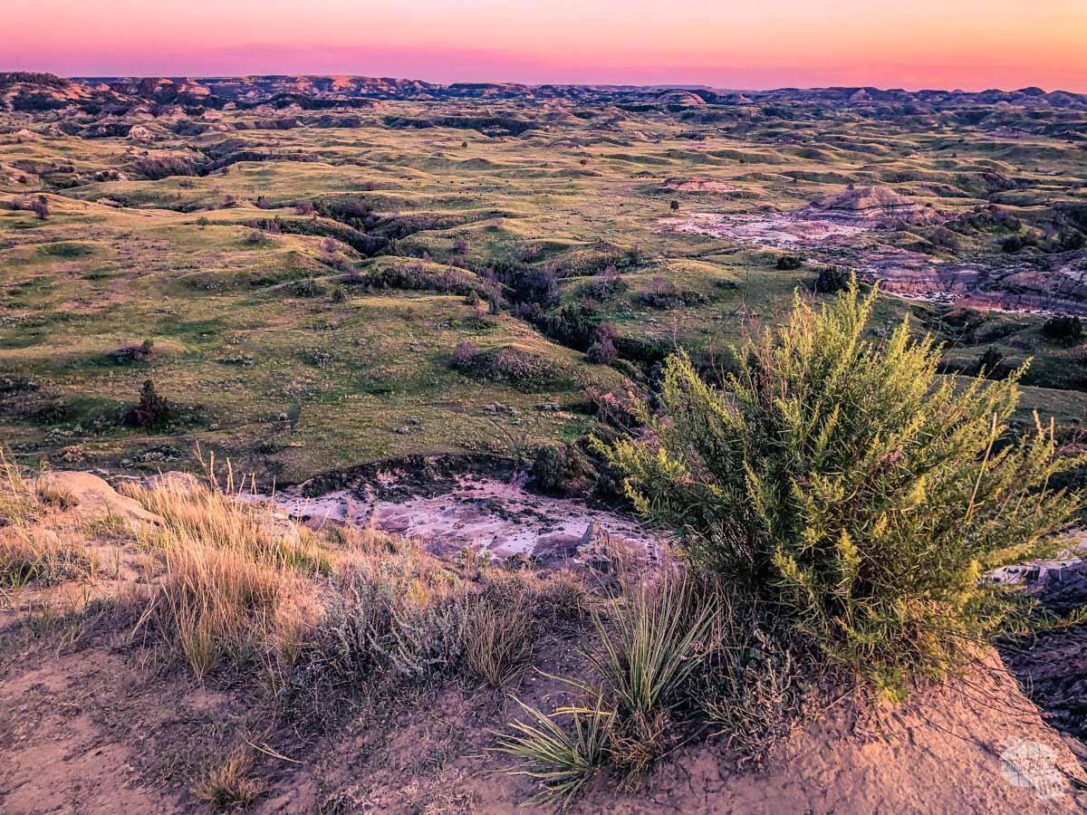
Badlands Overlook has some of the prettiest views in the park, hands down. Taking the drive all the way out here while the loop is an out and back drive is essential. I just can’t say enough good things about this view.
The next stop on the way down is the Old East Entrance Station. What’s really cool about this quick out and back trail is that it leads to the old entrance to the park. Before I-94 was built, this was how folks got into the park off an old highway.
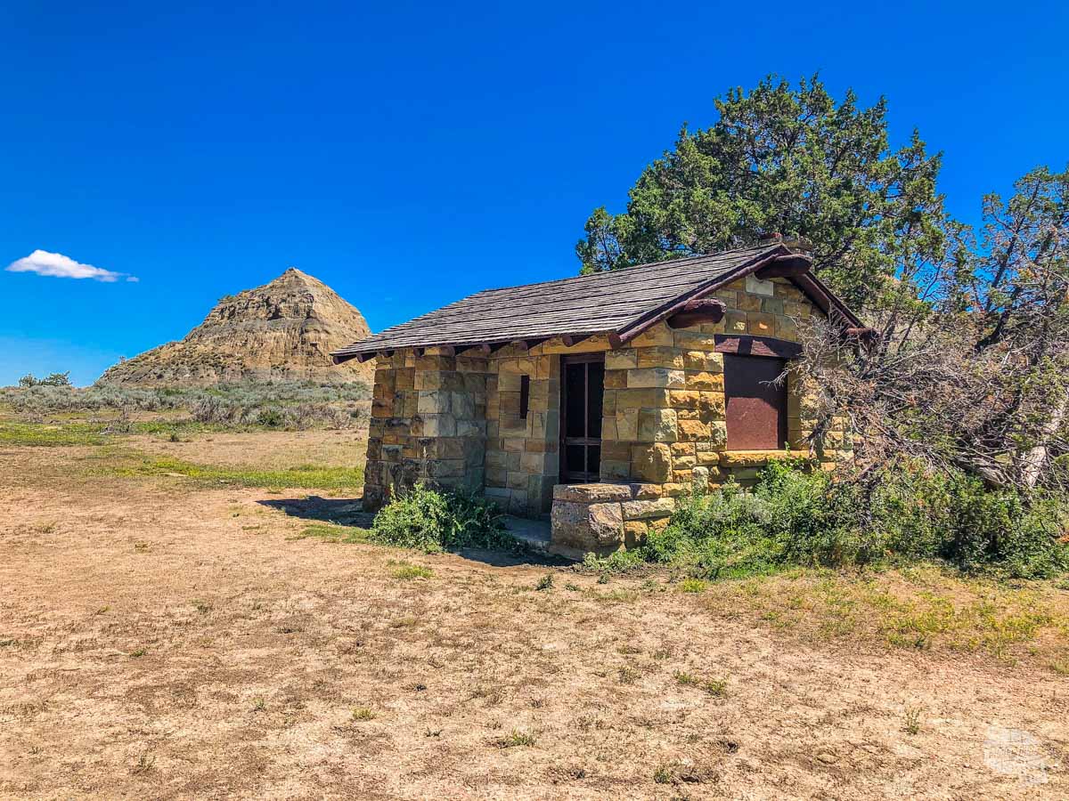
The building is a classic example of Civilian Conservation Corps construction, which did an amazing job of building things that contributed to the landscape rather than distract from it.
The other really cool thing about this mile-long trail is that it crosses through a prairie dog town. It was really fun to see how these prairie dogs, who are not as accustomed to humans as the ones by the Skyline Vista, react to people walking by.
In all, this trail took us about 20 minutes but it was worth it.
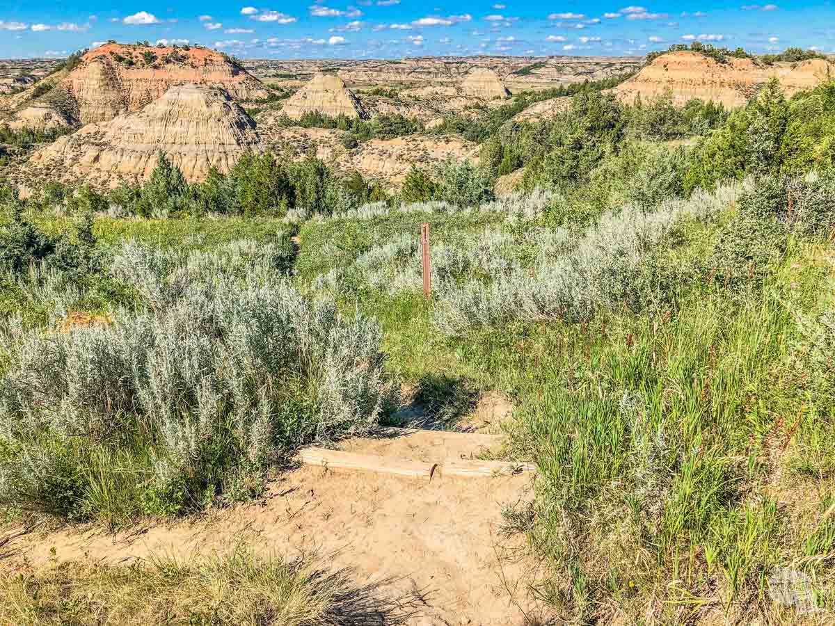
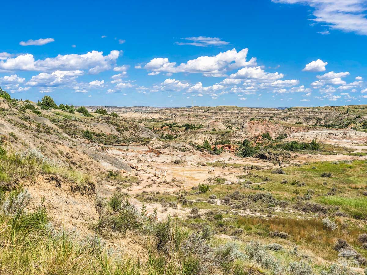
Coal Vein Nature Trail and Buck Hill
If you only do one trail when visiting Theodore Roosevelt National Park, this is the one you should do. It is a mile-long loop with a few ups and downs but otherwise is relatively flat. Make sure you grab a trail guide, either here or at the visitor center beforehand.
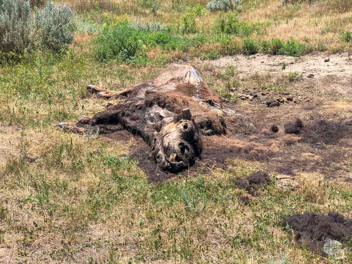
As we headed out on the trail, we spotted a bison carcass right off the trail. No idea what killed it but it was still really cool to see. Continuing around the loop, we were rewarded with views of the small canyon below us and plenty of rugged badlands all around. It is a short but beautiful trail.
Buck Hill is a neat stop. The short but steep uphill gives you a panorama of views on some of the only original prairie left in the park. What makes this place unique is it has never been plowed. That is rare enough anywhere on the Plains.
We chose to picnic atop the opposite hill, enjoying a quiet, if windy, spot with great views as well. It’s a quick stop but worth it.
Boicourt Trail and Wind Canyon Trail
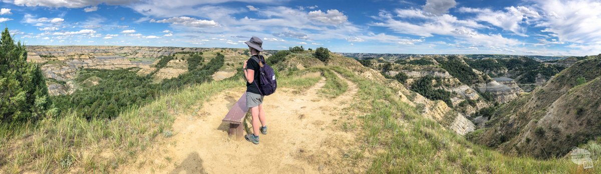
Another amazingly scenic spot is the Boicourt Trail. This short trail takes you out to a narrow ridge with some of the best views in the park. We came here twice to watch the last light at sunset.
One thing to note about this trail is it is popular with bison. On our second sunset out here, we had a bison bull begin to climb up from the valley below and a small herd of bison come between us and the parking lot. At neither point was there any concern but bison are erratic and we had quite a run-in with a small herd up in the North Unit.
There is a decent drive between the Boicourt Trail and Wind Canyon Trail with plenty of amazing views. It is also a popular route for bison as we have seen bison walking up and down the road every time we have come in the park in the evening.
As you get closer to the Wind Canyon Trail, take a moment and turn right onto East River Road. It leads to the north entrance to this unit and you never know what wildlife you might find that way. We found a small band of wild horses up there once.
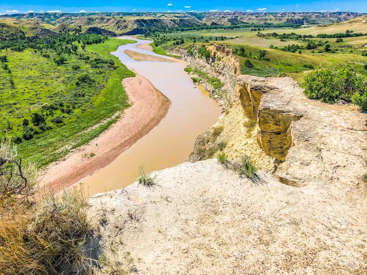
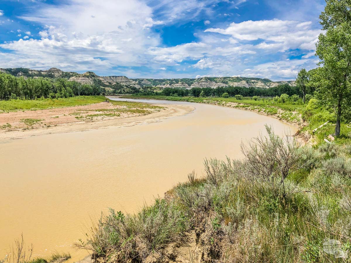
The Wind Canyon Trail is a quick, half-mile loop but takes you to an exquisite overlook of the Little Missouri River. It has a few steep parts but is otherwise quite easy.
The views are simply staggering. Be sure to watch the water for wildlife because you never know what you will see along the river banks.
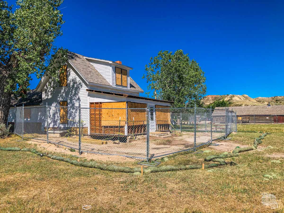
Peaceful Valley Ranch
Peaceful Valley Ranch, built in the 1880s, has served as a cattle ranch, a dude ranch, the headquarters for the CCC, the headquarters for the park and most recently for guided horseback tours. The Park Service is presently repairing the ranch before opening the ranch back up to the public.
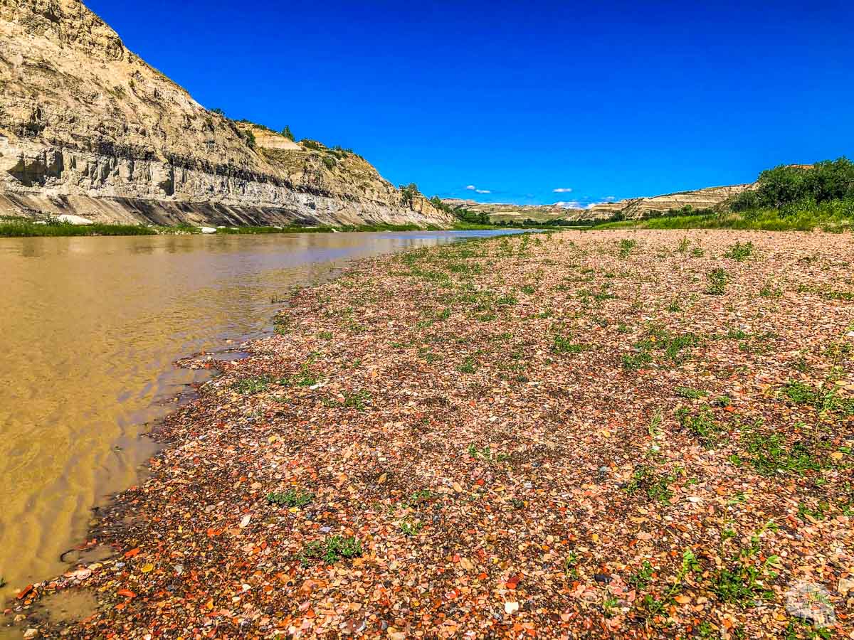
The ranch is also the trailhead for crossing the Little Missouri River to the Wilderness Area on the other side. There are several trails that cross that area, including the Petrified Forest trails.
We took the opportunity to walk down to the Little Missouri River to check out the riverbed. It is worth the quick walk down to the river.
Hiking the Petrified Forest
The best way to see the two Petrified Forest areas of the park is to leave the park, head west on I-94 and then take the first exit and head north. The signs will lead you to the west side of the park and the trailhead for the Petrified Forest trails.
The Petrified Forest Loop is a 10-mile trail that loops through the two sections to petrified forest and plenty of prairie.
Pro Tip: Always check with the rangers about trail conditions before doing any of the long hikes. The Bentonite clay in this park gets hazardous when wet.
That said, the sections of actual petrified forest are not that far into the trail and you can easily visit both sections by hiking out and back. After a long hike in the North Unit the day before, we opted to turn this into an out and back trail.
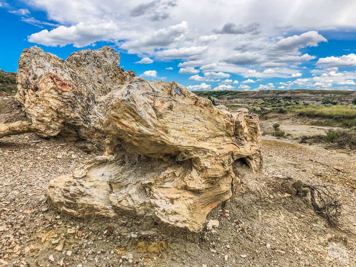
We visited the north area first, then the south area. Both contain significant deposits of petrified wood. If we were to only do one section, we would choose the south section. While the deposits of wood are smaller, the overall scenery is better.
In all, doing both sections out and back made for a 4.5-mile trail and it was quite good. Like other trails in this park, keep an eye out for bison. While we didn’t spot any except at a significant distance, we saw plenty of wallows and dung, indicating the bison hang out in this area often.
Walking the Elkhorn Ranch Unit
Getting to the small Elkhorn Ranch Unit can be a bit of a challenge. While we were able to pull up the site on Apple Maps, we were glad to have the printed directions from the Park Service.
The Park Service warns that the unpaved roads in this area can become treacherous after a rain because they can be washed out easily. Be sure to check on road conditions before you head out to this section of the park. That said, the roads were in great shape when we were there.
The Elkhorn Ranch Unit is mostly wooded and consists of a 1.5-mile out and back trail to the site of Roosevelt’s Elkhorn Ranch House. The trail is flat and easy and only took us about half an hour total (we would have taken a little longer to enjoy the area but a threatening thunderstorm shortened our visit). There are several interpretive signs along the trail. At the end is the site where Roosevelt’s cabin stood. There are a few foundation stones remaining but that’s it.
Still, it was cool to see and you can easily see why Roosevelt decided build a cabin here.
We came from the north after visiting Fort Union Trading Post National Historic Site. In all, we saw two gas stations and only one had a store associated with it, so make sure you have a full tank before making the trek to the Elkhorn Ranch Unit.
Read more about visiting Fort Union Trading Post NHS and Knife River NHS.
Visiting Theodore Roosevelt National Park’s North Unit
The North Unit of Theodore Roosevelt National Park requires a bit of driving to get to. It’s located about 50 miles north of Interstate 94 off Highway 85.
When you get to the North Unit, be sure to check in with the rangers about trail conditions in this unit of the park. Because of the distances involved, the trail conditions here can be drastically different than the South Unit. We hiked three trails while in the North Unit and encountered Bentonite clay on each of them. This is important because Bentonite clay can be hazardous when wet.
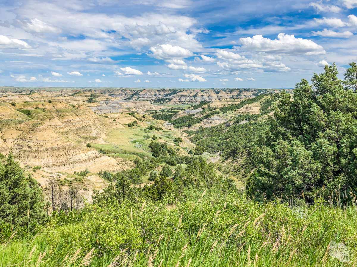
The main thing to do here is drive the scenic drive. While the topography is similar to the South Unit, we found it to be quite a bit more scenic, with quite a few more dramatic views. It’s more than worth your time to visit.
Pro tip: For whatever reason, the bison here seem a lot more skittish around humans than other bison we have encountered in other parks, even in the South Unit. Give them some extra space.
Driving the Scenic Drive in the North Unit
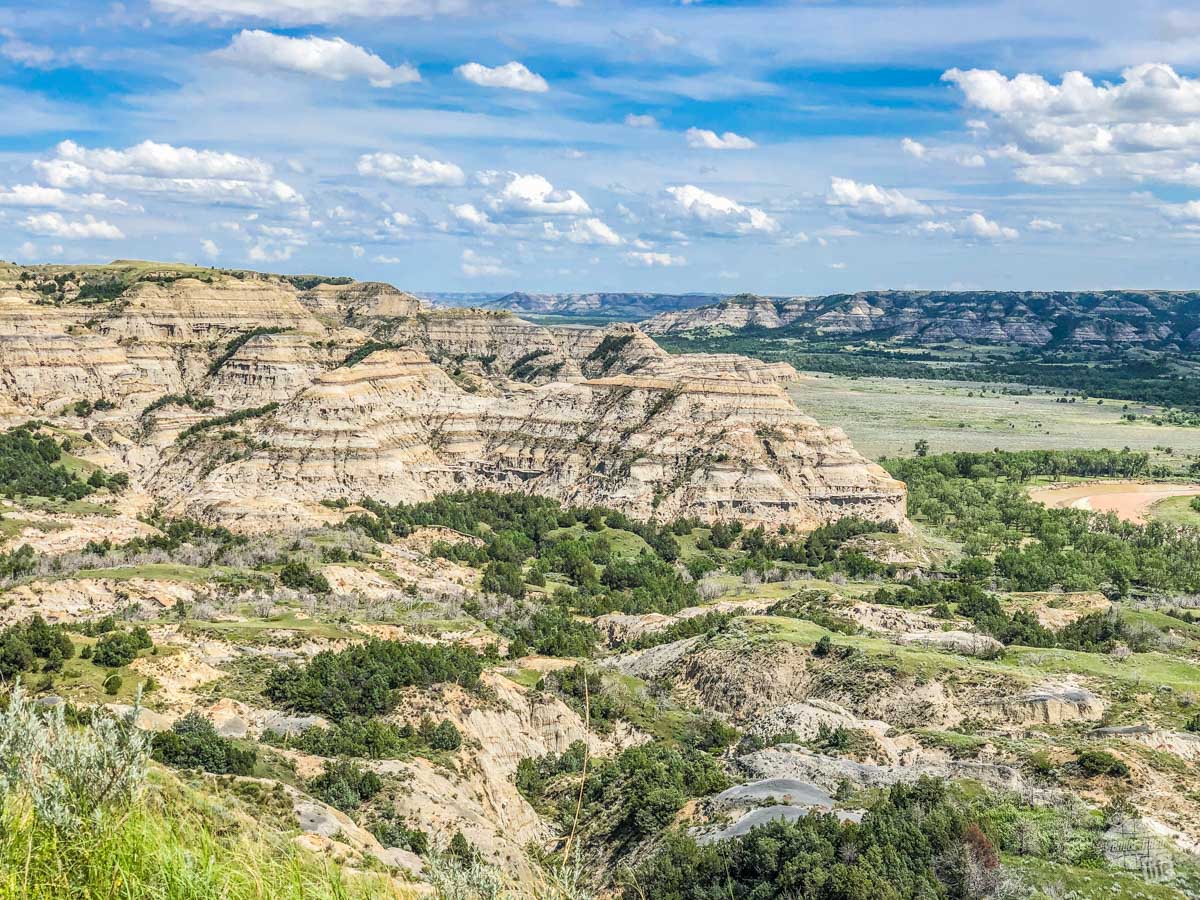
The scenic drive is a 14-mile road that leads into the heart of the North Unit with several stops along the way allowing for grand vistas of the Grand Canyon of the Little Missouri River.
As you drive in, you will notice a few pullouts along the way with informational signs explaining the geography and the history of the area. Right across from the turn off for the Juniper Campground, you will find a pullout for Battleship Butte. Be sure to stop here to see one of the most unique geological features of the park: the cannonballs.
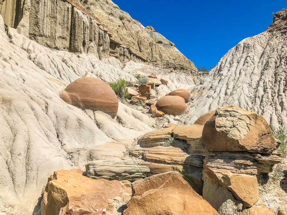
The cannonballs are concretions, a deposit formed inside a sedimentary rock that remains after the rock around it wears away. These spherical formations dot the ground here, with more working their way out of the surrounding rock.
Hiking the Little Mo Nature Trail
Just down the turnoff for the Juniper Campground is the trailhead for the Little Mo Nature Trail.
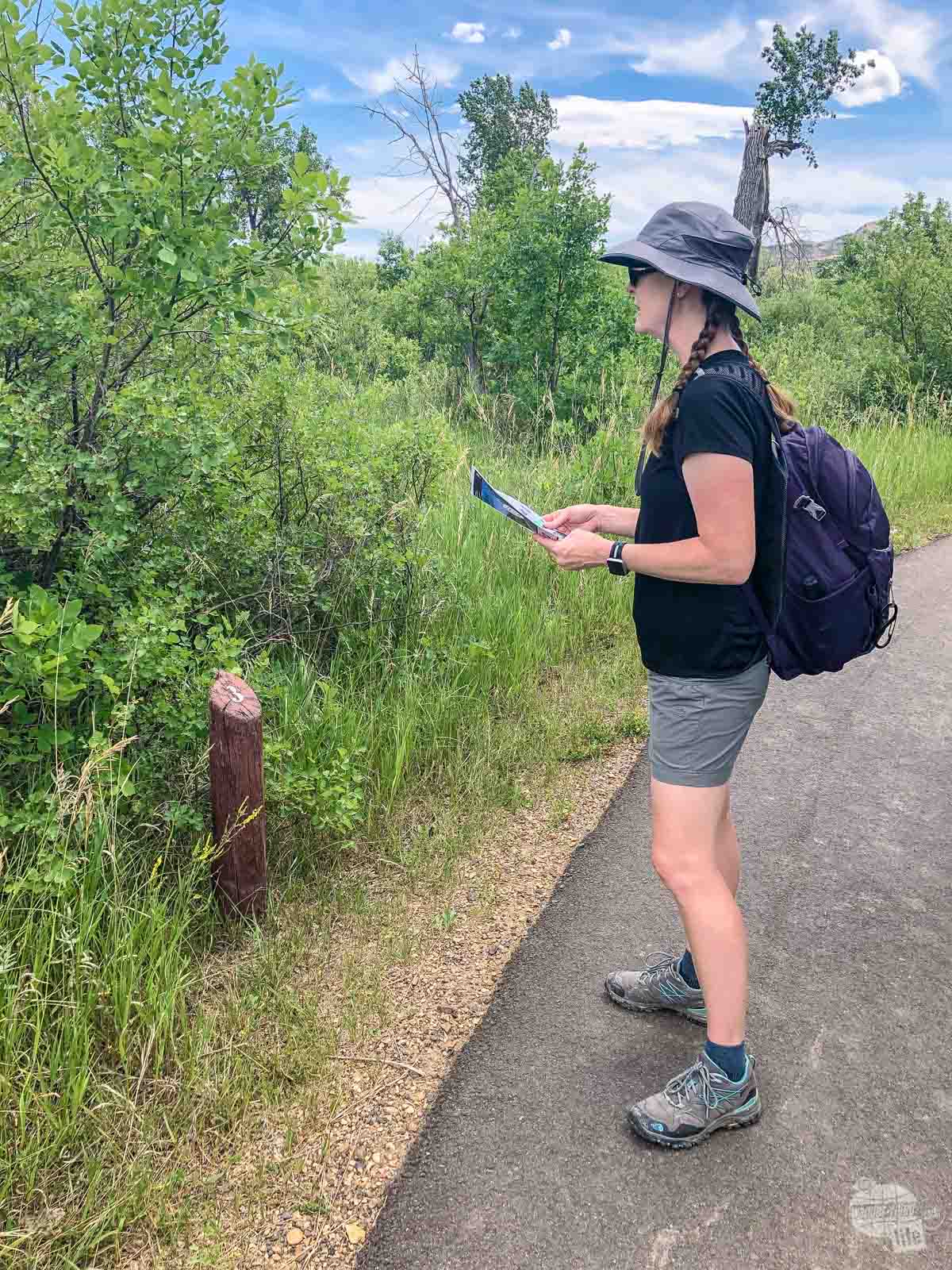
This is an interpretive trail with pamphlets at the trailhead and numbered markers along the way. It is a 1.1-mile loop, with an inner, paved loop and an outer loop that gets off the pavement to nice overlook. We recommend going right at the trailhead because the trail is easier to follow this way.
We had a bit of excitement on this hike. As we were looping back to the parking lot, we heard a piercing scream from ahead of us. As we rounded the bend, we found another couple on the trail backing away from a very aggressive snake!
Originally, we all thought it was a rattlesnake. It was coiling and flicking its tail just like a rattlesnake. The hiss it made sounded exactly like a rattlesnake.
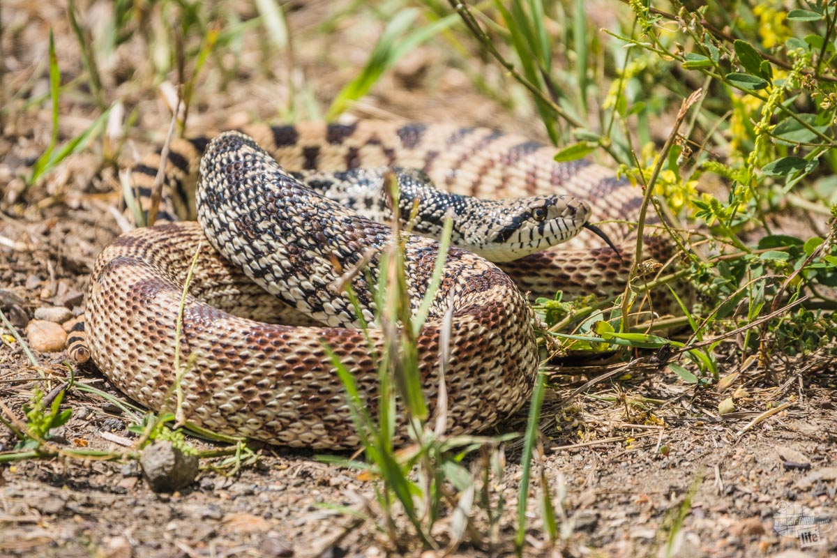
But, when I zoomed in with my camera, I could tell the markings weren’t right and I didn’t see a rattle. It turns out it was a bull snake emulating its venomous cousin. Apparently, the other couple had taken a couple of steps off the trail and drawn the ire of the snake.
After the other couple left, the snake immediately calmed down and retreated back into the brush. It was a little heart-raising but still a very cool thing to see.
In all, we spent about 20 minutes on this trail.
Aside from the campground, you can also find a rather nice picnic area among the cottonwood trees a little further down the road for the campground.
Caprock Coulee Trail – Our Favorite Hike
It is not hyperbole to say the Caprock Coulee Trail is one of the best hikes we have ever taken, so much so that I’m writing a separate article on this hike. It is a 4.4-mile loop with a nature trail component at the beginning of the trail if you take it counterclockwise, which we recommend.
We took this trail clockwise to get the uphill out of the way right off the bat. The uphill was not bad but, honestly, the trail would have been better, scenery-wise, by going the other direction. The other drawback to going clockwise is we did not get as much out of the nature trail portion because we were a bit tired from our hike on the way back to the truck.
If you plan on hiking this trail, we recommend you go ahead and hike the trail before continuing on the scenic drive. The trail crosses back across the scenic drive a little further and you will want to save these views as a reward.
If you only do one hike in the North Unit, do this trail. We spent about 2.5 hours on this trail and it was probably the best time we spent in the park, period.
Read more about this trail, including almost being stampeded by bison, in Grant’s article!
River Bend Overlook and Oxbow Overlook
These two overlooks provide truly staggering views of the Little Missouri River snaking through the badlands of the park.
The River Bend Overlook is just past the Caprock Coulee Trailhead and the trail comes right through the parking lot, hence why I say hike the trail first so the views can be a reward for your hike.
Interestingly, the view was so popular that the Civilian Conservation Corps built a stone and log overlook at just the perfect spot even before the Scenic Drive was built. If you are not doing the hike, this stop is a must.
As you continue along the Scenic Drive, you top out onto grass-covered buttes. Keep an eye out for bison herds along the way. We spotted a few small herds along this stretch of the road.
Oxbow Overlook is the end of the Scenic Drive and overlooks an oxbow bend in the river below. It also serves as the trailhead for a couple of the longer, backcountry trails and the Sperati Point Trail.
This 2.4-mile out and back Sperati Trail is an easy hike out to an interesting viewpoint overlooking the river. It’s a nice trail but the views are not that different from the overlook. Still, we enjoyed it and were glad to get out on the trail here. The trail took us a little less than an hour to complete.
Where to Stay
The easy choice in terms of where to stay when visiting Theodore Roosevelt National Park is Medora. This small town has embraced the tourist nature of being a gateway city to the national park and has a few hotels, some pretty good restaurants and a seriously fun show: the Medora Musical.
Read more about Medora in Bonnie’s article.
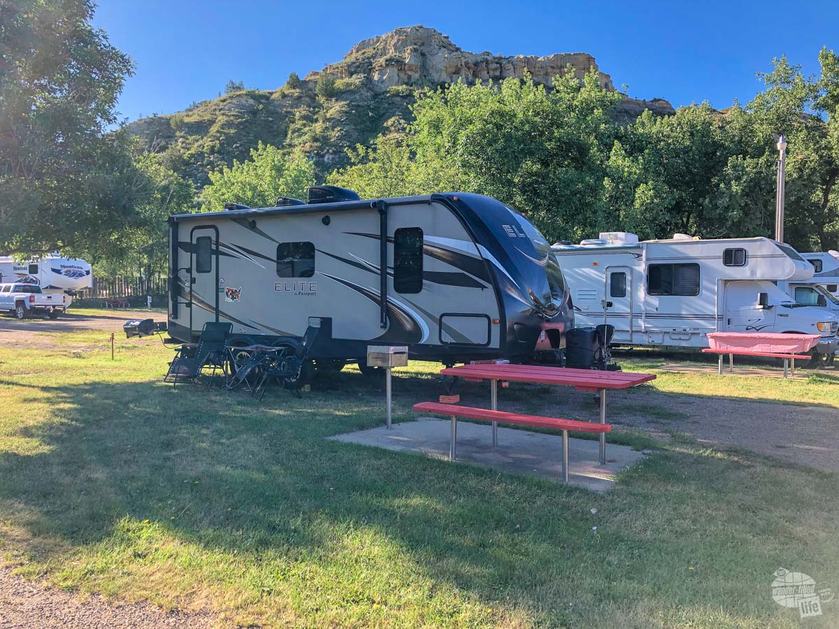
We stayed at the Red Trail Campground, which we found to be quite comfortable. The sites were level, the bathrooms were clean and the folks were nice. The campground is located walking distance into town, which we really liked.
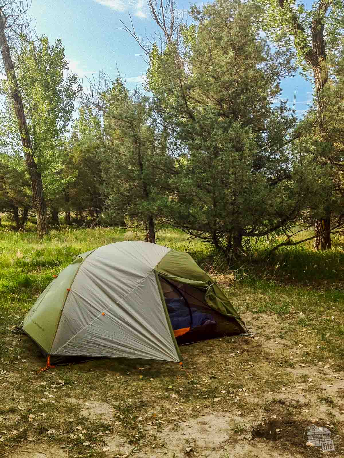
We did stay in the park at the Cottonwood Campground many years ago on our first visit and found it comfortable when we tent camped. It’s been a while, so I can’t really say much more than that.
Final Thoughts on Visiting Theodore Roosevelt National Park
This was our second visit to this park and we are really glad we decided to spend the time to give this park several days. On our first visit, we simply did not spend enough time here to truly see and enjoy the park beyond the Scenic Loop Drive in the South Unit.
This time, we took our time visiting Theodore Roosevelt National Park. We hiked the trails, drove into the park several times at sunset to enjoy the evening views and generally immersed ourselves so much more into this park. We also took the time to enjoy the town of Medora and see the Elkhorn Ranch Unit.
It was so worth it. This park has so much more to offer than we would have guessed. Plan on spending more time here than you would think you need. You will thank me later.
Travel Resources
What do you use to find a flight?
We use Skyscanner to find deals on flights. Skyscanner has a great interface and compares tons of airlines for the best pricing and routing. That said, it does not always have every airline and some airlines will have better deals on their website. Still, Skyscanner is a great place to start.
Click here to search for a flight.
What do you use to find a hotel?
We typically stay at Hilton properties, so we use the Hilton website. You can find good Hilton Honors discounts or AAA discounts for a hotel there. We make great use of our free night certificates from our Hilton Honors American Express.
Click here to book a Hilton property.
If there are no Hilton properties available, we use TripAdvisor to read reviews and book the hotel. We find we can get the best price that way.
Click here to search for a hotel.
We recently partnered with Stay22 to add interactive maps to each of our destination posts. This will allow you to see a plethora of hotels and vacation rentals all in one responsive map of the area.
What if I need more space than I can get at a hotel?
We use Vrbo for the times when we have rented a cabin for a weekend getaway, like this cabin in Townsend, TN, or needed to rent a house for a large family vacation. We had a great experience with them in terms of refunding deposits when COVID hit and will continue to use them.
Click here to search for a vacation rental.
Who do you use for rental cars?
As a general rule, we book with Hertz for rental cars. We have had nothing but good experiences with them. Plus, we really like unlimited mileage and not worrying about crossing state lines. We have even rented from Hertz overseas in both Slovenia and Croatia.
Click here to book a rental car.
How about booking a cruise?
We have found some amazing prices for booking a cruise through Cruise Direct. We have saved a lot of money on our cruises compared to what we found elsewhere, making a last-minute Bahamas cruise even cheaper.
Click here to book a cruise.
What if I want to rent an RV?
We highly recommend Outdoorsy for RV rentals. We rented a camper van for a week to visit Rocky Mountain National Park for the elk rut and Custer State Park for the Buffalo Round-Up and had a blast. The program was easy to use and we really enjoyed the freedom of having a camper van for that trip.
Click here to rent an RV.
What do you use for booking tours?
We don’t often book tours. Typically, we like to do stuff on our own. That said, there are some experiences you can’t have any other way. So, when we do want to book a tour, we always check Viator first.
Click here to book a tour.
Do you use anything to get discounts on the road?
We make extensive use of both Good Sam and AAA on the road. Good Sam is normally regarded as a discount card for RVers at campgrounds and Camping World but anyone can use the 5 cents off a gallon at the pump at both Pilot and Flying J.
Click here to get a Good Sam membership.
We have had AAA as long as we have been married and it has more than paid for itself in discounts at hotels, aside from the peace of mind of having roadside assistance. Add in paper maps and the ability to get an international driver’s license and it is more than worth it for any traveler out there.
Click here to get a AAA membership.